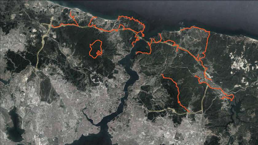
Istanbul Walkabouts uses critical walking as a methodology to explore, record and map northern Istanbul. Unlike urbanized, industrialized and populated global city; sparsely populated northern Istanbul consists of water reserves, forests, quarries and farms lands. Simultaneously, this region houses Northern Marmara Highway that not only connects Asia to Europe over Bosphorus for the third time but also acts as a spine to forthcoming megaprojects like ecologically catastrophic artificial strait or world’s largest airport. As Istanbul Walkabouts investigates territories the highway transits directly on site with the archaic and anthropic mode of moving about the Earth, it constitutes a critique of the neoliberal operations on northern Istanbul and creates awareness and transparency about these territories by walking around them. Ultimately, it intends to produce a resistance to top-down urbanization policies and establish a platform of discussion and discourse to inform future urbanisms.
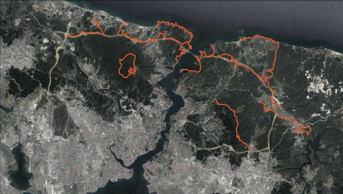
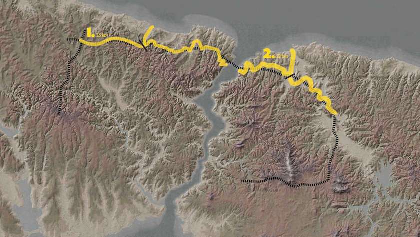
The project that started as solitary walks evolved into curated walks done with 250 participants. After walking 235km on differing routes with varying capturing modes and multiple encounters within physical, seasonal and temporal changes; the walks constituted their own methodology to explore transforming landscapes. The aspiration of Istanbul Walkabouts is to share this experience of employing the archaic and anthropic practice of walking to reflect upon current operations and future urbanisms.
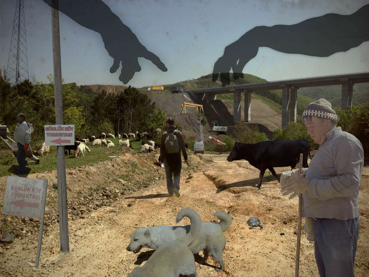
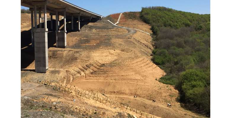
Dioramas are performative representations of a particular walk formed with photographs taken during the walk. This one points to the critical phase where ubiquitous elements of transport infrastructure meet the current occupants of northern Istanbul. A flock of sheep, shepherd, his dogs, turtle, walker, cow, signs of ‘farmers’ eggs’, bugs, beekeeper and hives - all encountered and pictured during the walk. Celestial hands are plunking down transport infrastructure from above – deus ex machina.
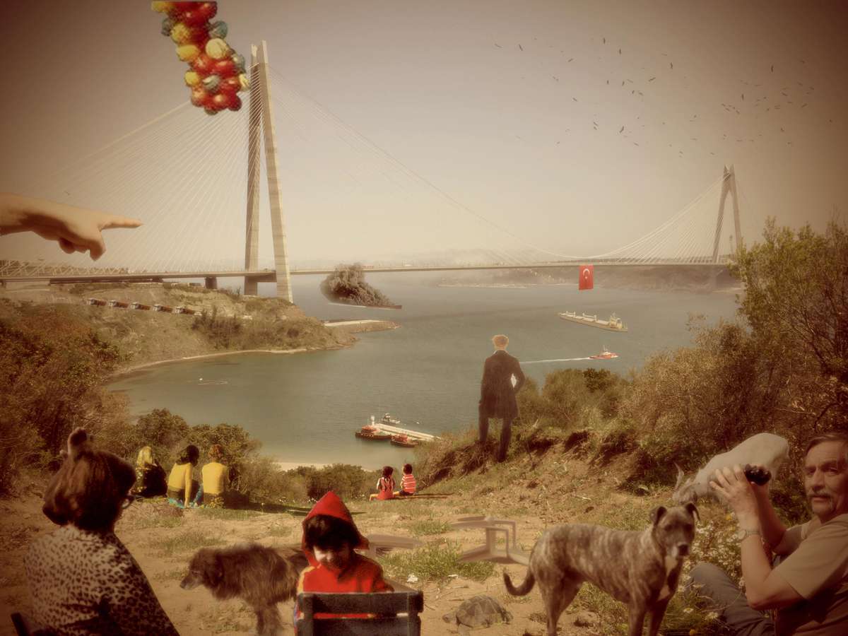
This diorama looks at the confluence of Black Sea and Bosphorus which has been there forever. Still, this is a new landscape as the Third Bridge has just been built. The wanderer from Friedrich's painting looks down from a cliff and schemes on how to operate upon this geography, a prophecy of the top-down approach of urbanization. With dioramas, the agency of representation is not addressed as the production of a static map but as a projective mode of perceiving and mapping the world.
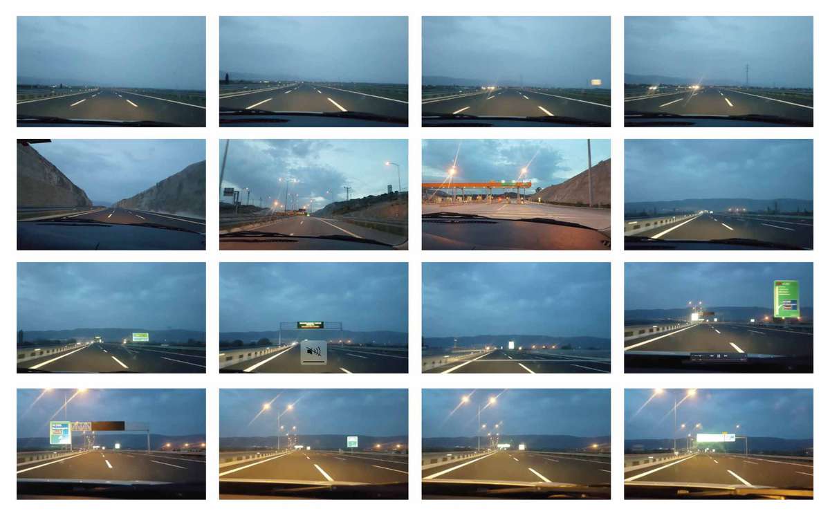
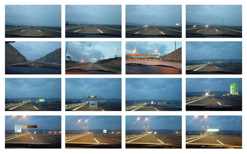
These are stills from a GoPro video taken while riding a car on the Northern Marmara Highway. Transport infrastructure shortcuts the terrain, all of its characteristics and its human and non- human actors. Istanbul Walkabouts experiences these geographies through walking speed and human scale. Passing the highway with a car without the consequences and impacts of any geographical or topographical traits takes less than an hour. The walks, altogether, lasted 82 hours.

Within the absence of a coherent urban theory, dubiousness and unreliability of law, impossibility of direct action in Faustian Istanbul, walking is an alternative methodology of critique and resistance. The critical action of walking produces critical reflections on operational territories. Eventually, Istanbul Walkabouts anticipates continuing the walks on routes derived from previous walks and initiate platforms of discussion to imagine potential futurisms of transforming landscapes.