- Site-specific cases
This project looks critically to one of the latest colonization project on the planet - the appropriation of local resources and development of the arctic zone. This touch upon a very challenging theme of indigenous cultures and the confrontation between contrasting notions of territory by the so called «western» thinking and indigenous thinking. Our project intends to produce a designed mechanism, based on a variety of existing and designed physical boundaries, by which land management, the introduction of new land usages and their seasonal changing boundaries, can be accessed, built and negotiated by relevant local actors/people.
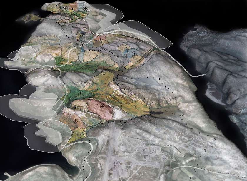
We chose Tommerneset peninsula in Northern Norway as our study area, where four new big ports developments are now planned and where anticipate disruptions in the historically Skolt Sami territory will need to be addressed for the foreseeable future.

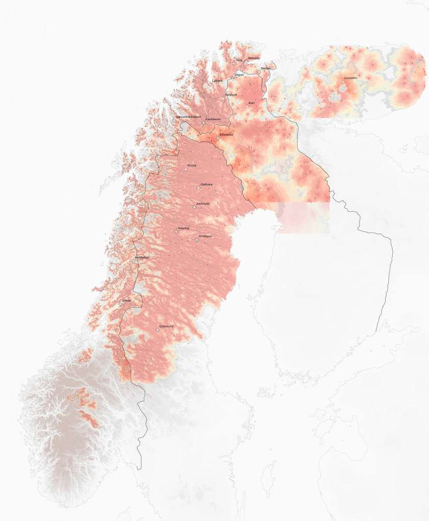
Sapmi map showing the Sami zone of actvity. Mapping nomadic people prompted to look critically at mapping as a whole. Sapmi map does not show the borders of Sami lands - traditionally, Sami do not have fixed borders - their lands are shared and borders are flexible. Map shows the ‘zone of activity’ of Sami on the territory. As they are constantly migrating we can follow their migration routes. From red to white - from very oftenly used to rarely occupied.
Siida map showing the shift from intensive to extensive herding that happened during the XX century. Intensive herding mostly can be described by less land plots needed for herding, while all family members were involved in reindeer herding. Extensive herding is getting more spread nowadays,
as Sami are urged to have bigger herds and therefore bigger land plots under one Siida, as they have more power and voice arguing with development corporations and the Norwegian state.
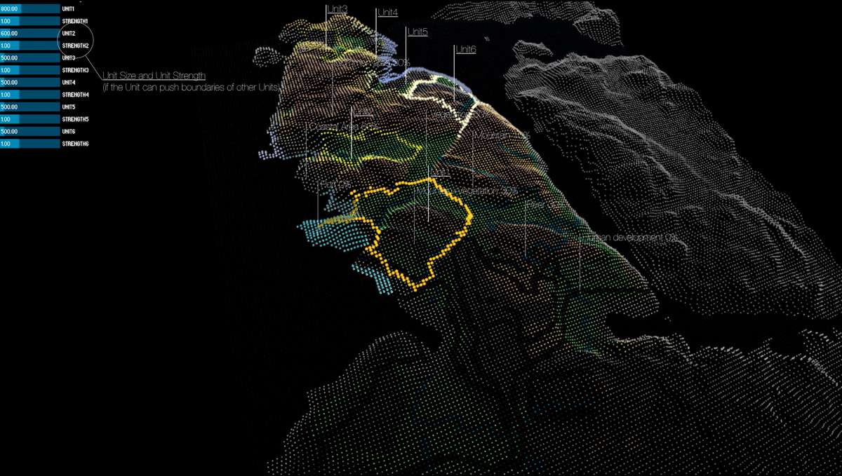
Management tool: Start and finish condition of the tool running in processing sofware. This applica- tion shows the area claimed by different people and the boundaries of their land plots. When the application is running the boundaries of land plots are growing or shrinking, trying to reach their estimated size. Estimated sizes of land plots are defined by the actors, and can be changed in real time with the sliders(top left). Actors can also adjust the ‘strength’ of the boundary.
Main Actors in Tommerneset: There are 5 main actors claiming the land on Tommerneset peninsula. These are Sami reindeer herders, future ports, military defense forces, tourist agencies and the airport. The activity of the actors change seasonally, for example tourist activity is only winter right now, while military forces shooting exercises expand in summer. Reindeer herders change seasonally - two different Siidas are coming in winter and in summer, while ports operate all year round.

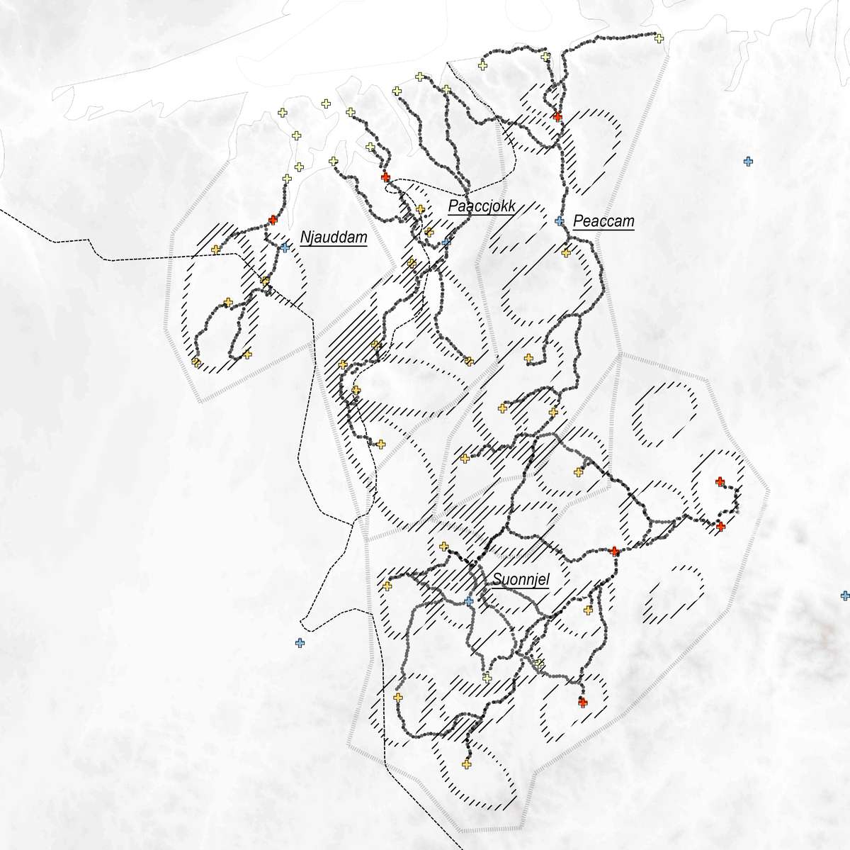
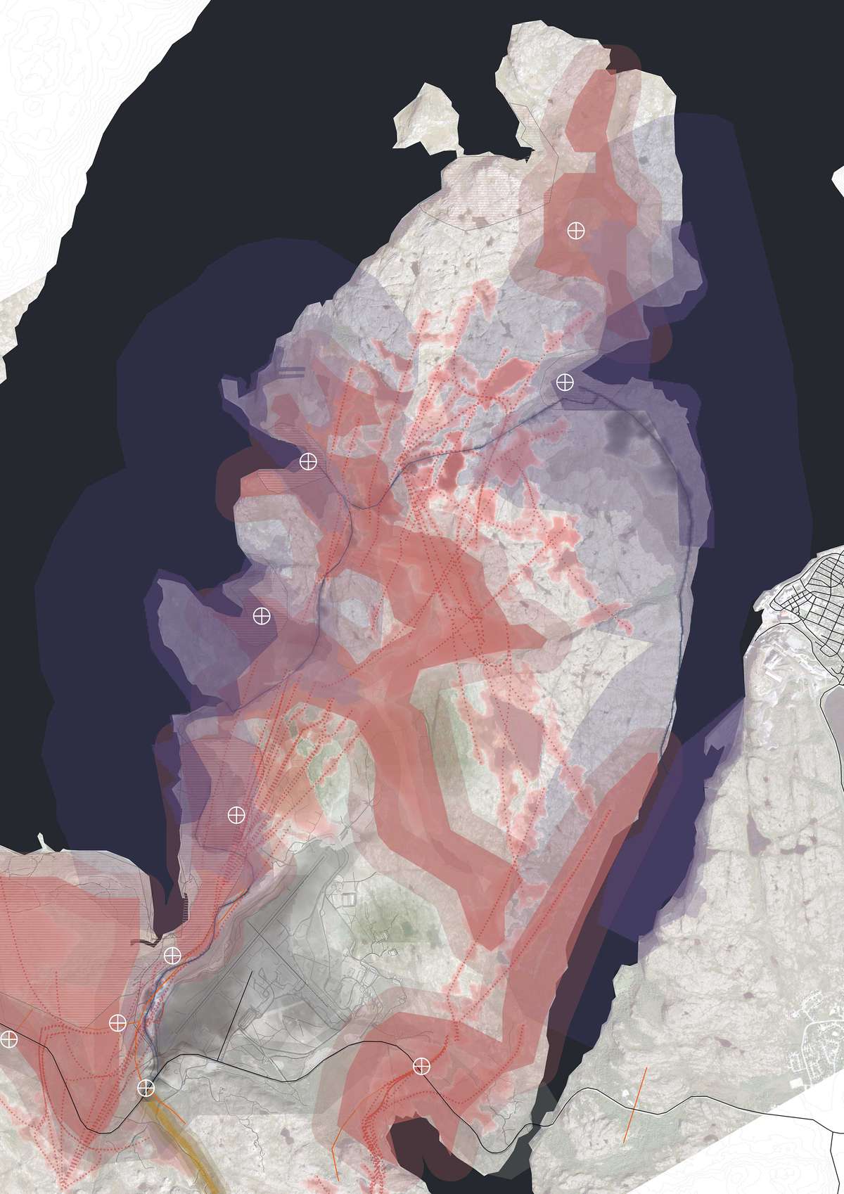
The physical application of the boundaries are shown on this map, with the division of each unit into the zones of application of a boundary type.