- Site-specific cases
At the border, divisions and separations emerge as forms of physical barriers while various political, cultural, and environmental conditions converge and challenge any attempt of control and demarcation. Sometimes these overlapping manifest in the form of conflicts. But in others as spaces of transition, negotiation, and appropriation. The project seeks to advance narratives of these contested spaces consistent with local experiences - and unpack counter-narratives to those that raise fear and exclusion. It utilizes postcards as a research tool to draw site-specific stories. By engaging with communities, the project visually unpacks complex socio-ecological narratives of the border region and depicts the unique border landscapes from which these stories emerge. At the border, we find that these local narratives challenge divisive notions of infrastructure and institutions and contribute to a wider frame of discourse on the urban studies of border regions at large.

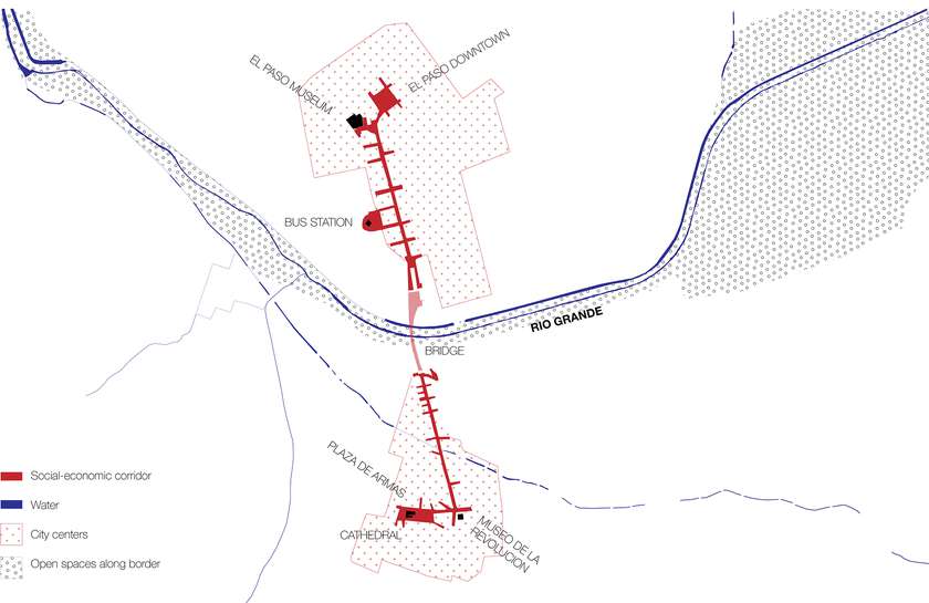
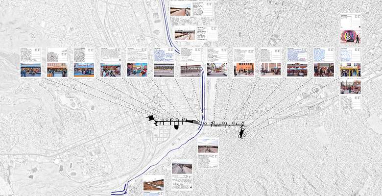
The corridor of El Paso Street, Av. Benito Juárez, and Av. 16 de Septiembre is an urban space that connects the two central areas of the cities in a walkable time of 20 minutes. This “bi-national” corridor facilitates systems of exchange in which a variety of urban activities, people and goods flow with different degrees of continuity and discontinuity across a landscape complicated by international trade agreements, citizenship rights, and cross-border infrastructure.
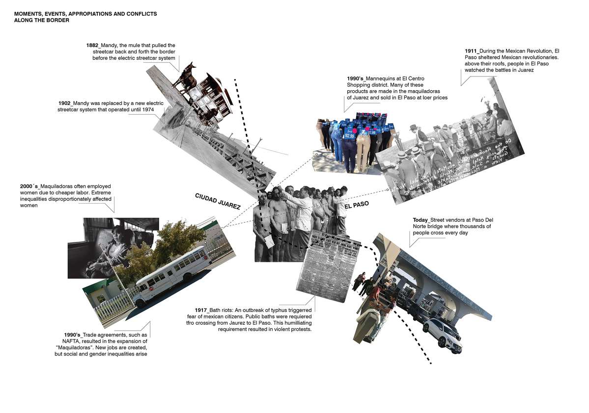
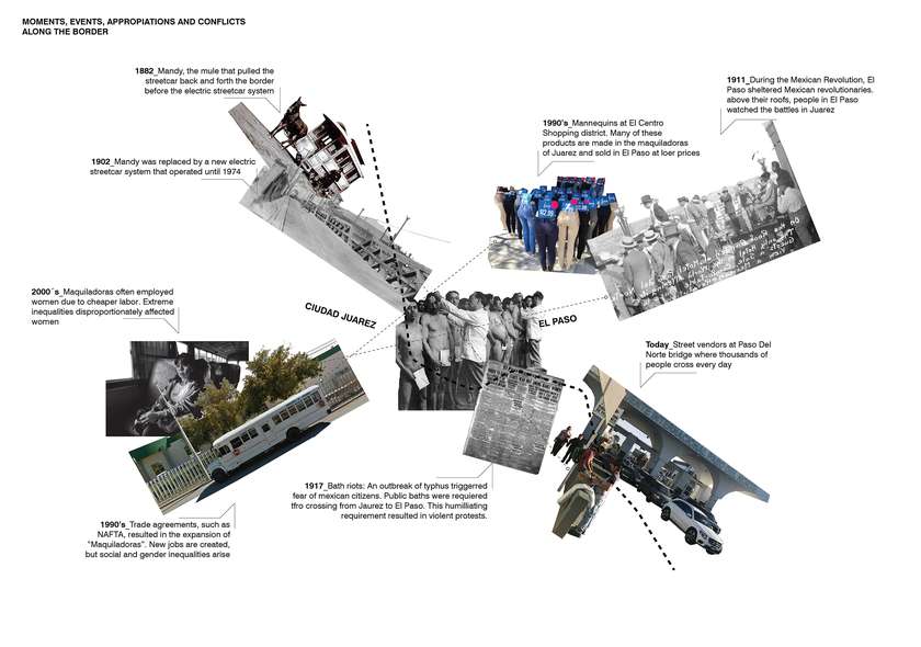
El Paso and Ciudad Juárez share a series of episodes along with the region's history. These particular narratives describe the systems and flow between the two cities - its continuities and discontinuities. The channelized Rio Grande or Rio Bravo - a body intervened, which acts more as a physical barrier between the two cities - overlaps with a timeline of events, appropriations, and conflicts transpired from 1882 until today.

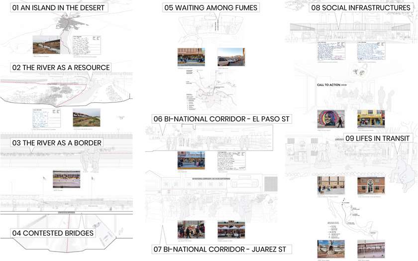
From postcards, interviews, and pedestrian encounters, we identified a series of urban moments that intersect, overlap, and complement each other. These moments take place along the river and its infrastructures of control, in the bridges, in the bi-national corridors, and in buildings that perform as social infrastructures. A series of drawings show these interactions in perspectives, sections, and elevations and create a unique narrative of these border landscapes.
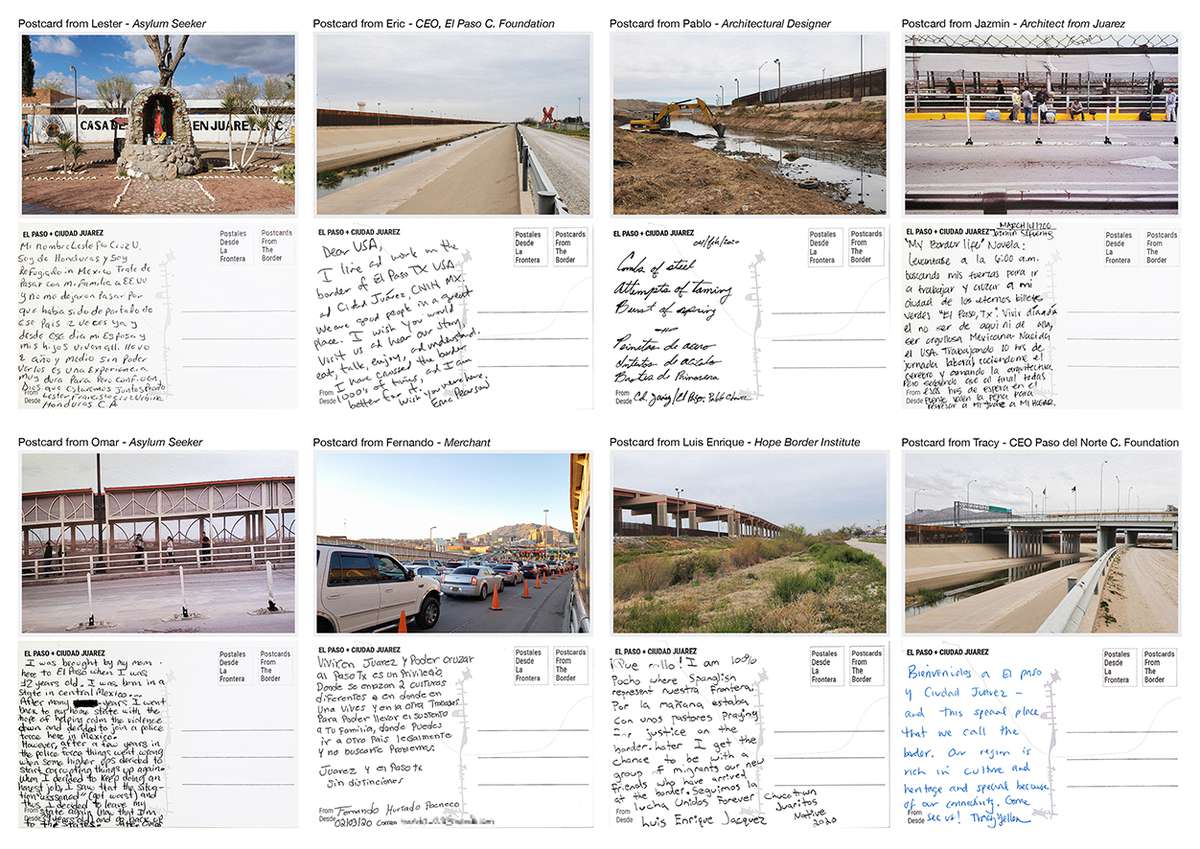
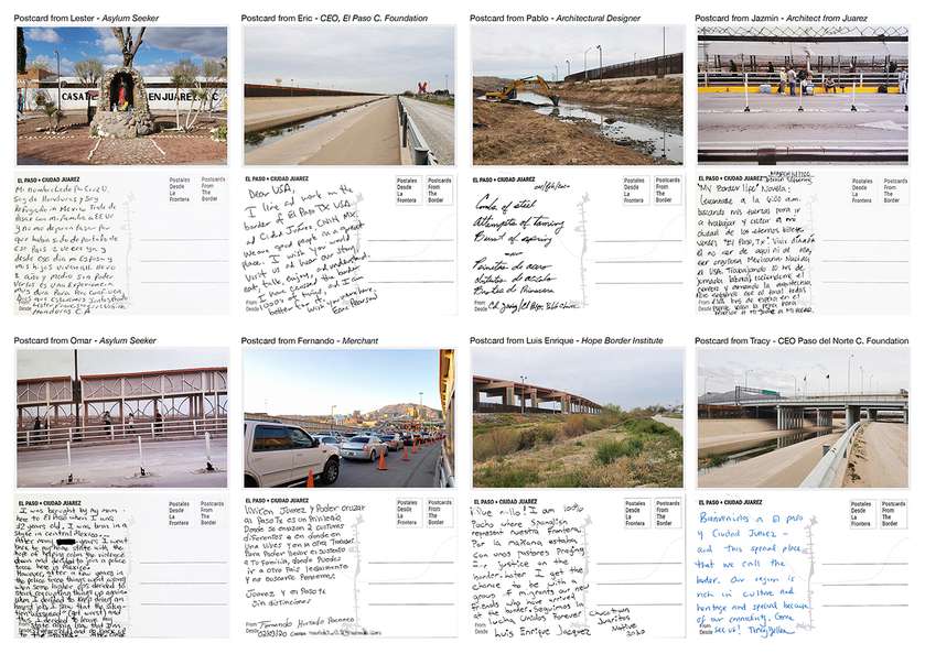
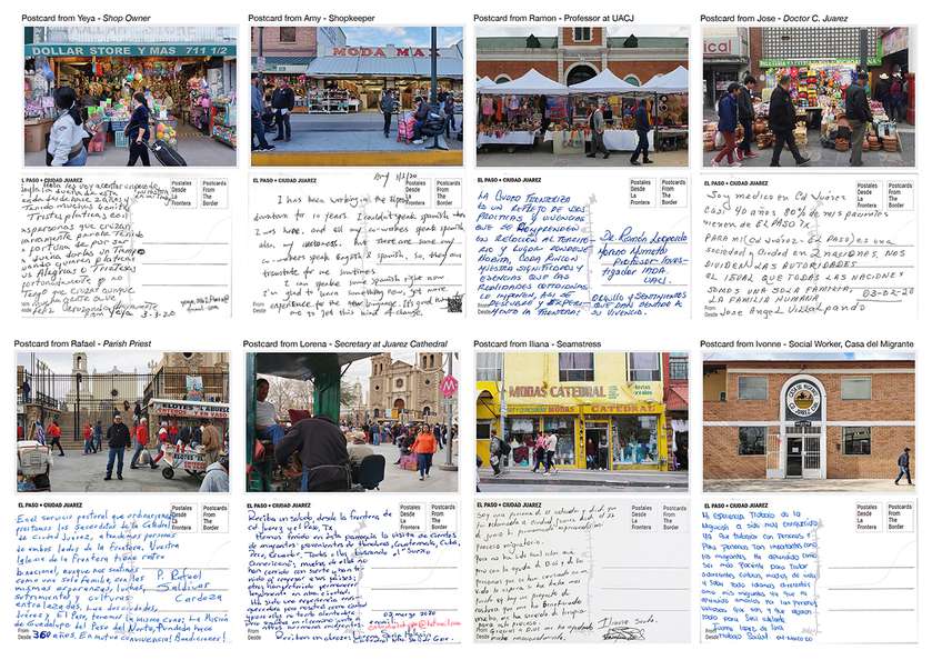
These postcards depict landscapes and stories told from various perspectives. The images, taken and printed by the authors in situ represent the layered experiences of each encounter with asylum seekers, community leaders, people who cross the border daily for work as well as those without the authorization to cross.

Each postcard is a representation of hours of conversation with each person and an exchange of experiences. The sites. located along the transect of the corridor and the river, reflect the play of contrasts between the two cities as well as the binational character of the region.