- Systemic changes
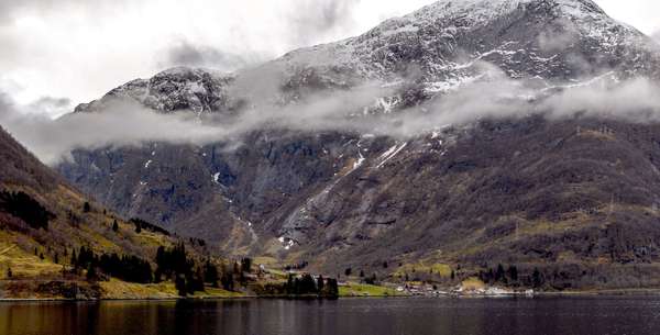
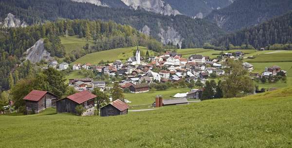
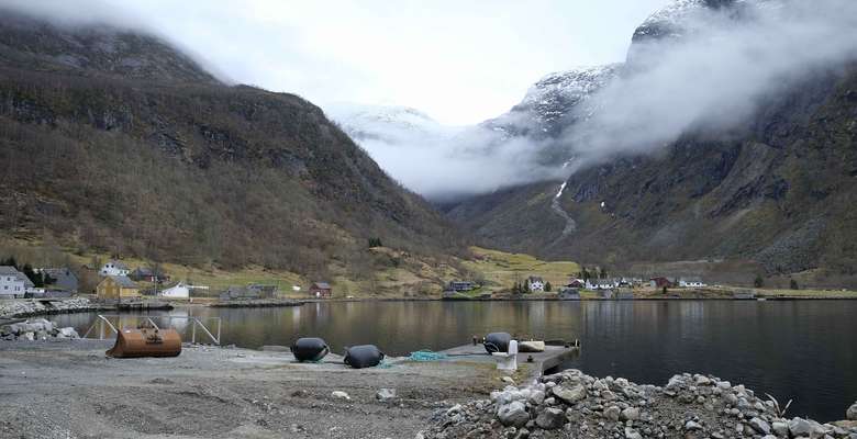
Rural Western Norway has faced down-spiraling demographics for decades due to de-industrialization and mechanized farming. Decreasing population leaves towns and villages vulnerable to threshold effects related to social infrastructure, making it difficult to sustain a functional community. Specific environmental conditions and natural hazards augmented by climate change put severe restrictions on land-use. Within this context, the project searches for specific and precise spatial strategies: a kind of rural acupuncture that has the potential to support the community by tapping into the social capital, making it more resilient and attractive to new inhabitants. Since these communities have lived through a period of de-facto degrowth, the project aims to draw on their successful experiences in order to develop strategies for cities and urban neighborhoods faced with the emerging challenge of degrowth. Current study cases include the towns of Mauranger, Stryn, Rosendal and Hjelle.
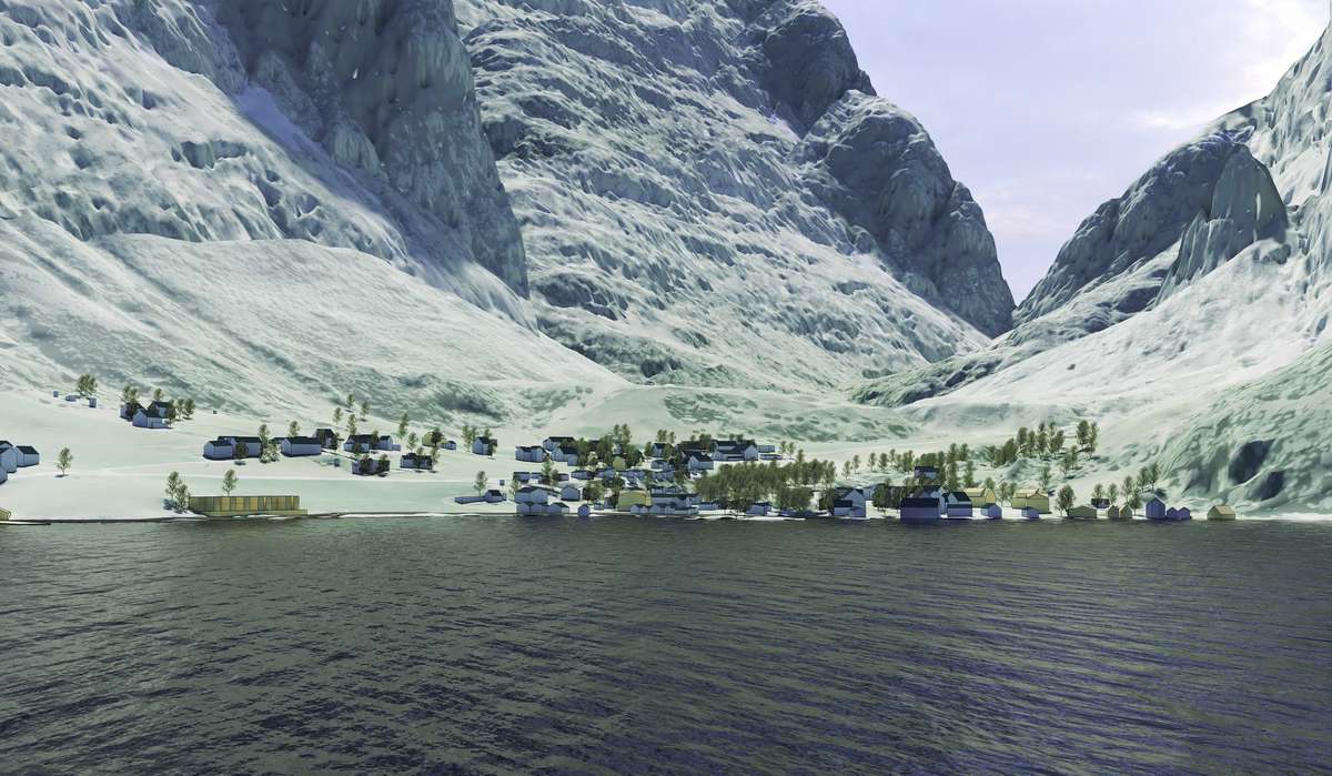
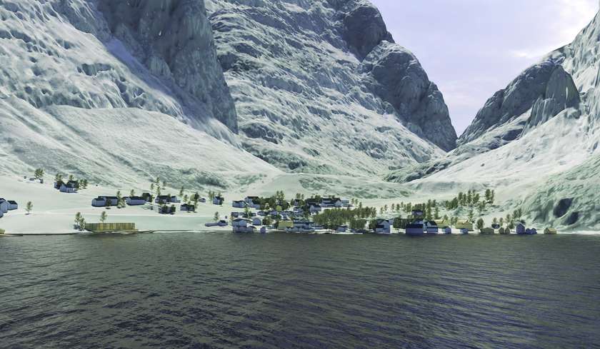
Rendered 3D study showing the existing village infrastructure (blue) and the proposed new development for densification (yellow) informed by local perspectives and analysis of cultural heritage, agricultural land and natural hazards.

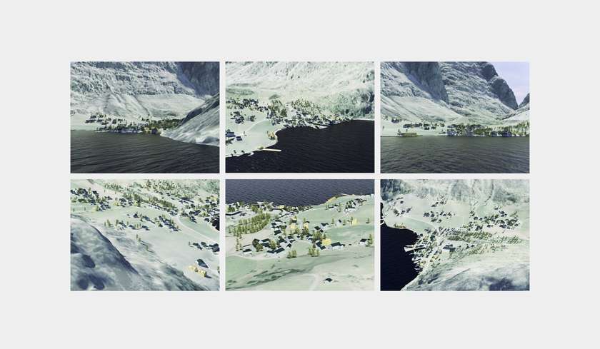
A collection of rendered 3D studies showing the existing village infrastructure (blue) and the proposed new development for densification (yellow). One standard graphic style is used to represent all sites, in order to facilitate future comparisons and ease sharing with different publics. A visual database of sorts emerges.
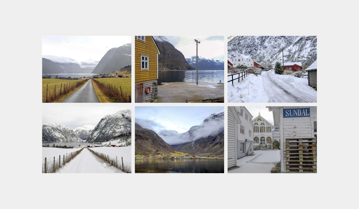
Parameters such as seasonal changes, water proximity and architectural preservation emerge as key notions when planning for the future development. Site visits are pivotal for reading the historicity of the villages. The landscapes tell the tales of a natural history of landslides and floods, as well as the cultural heritage and traditions of farming, industry, trade and tourism. The contextual description needed to capture the sense of place requires a first-hand experience.
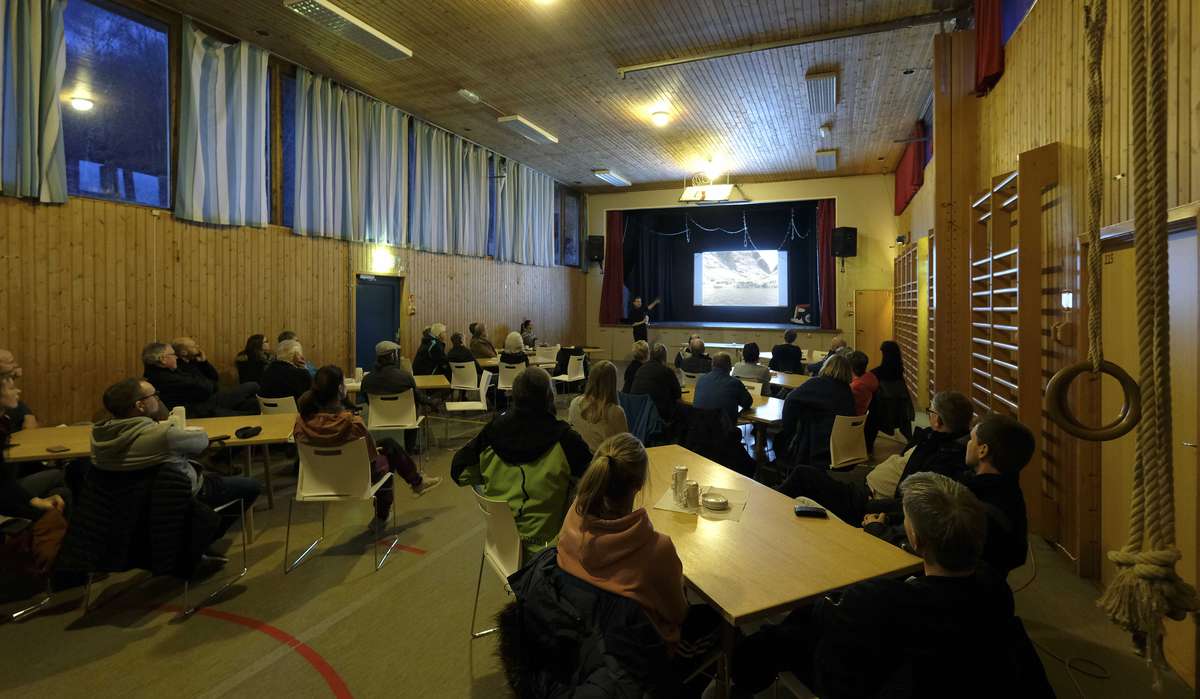
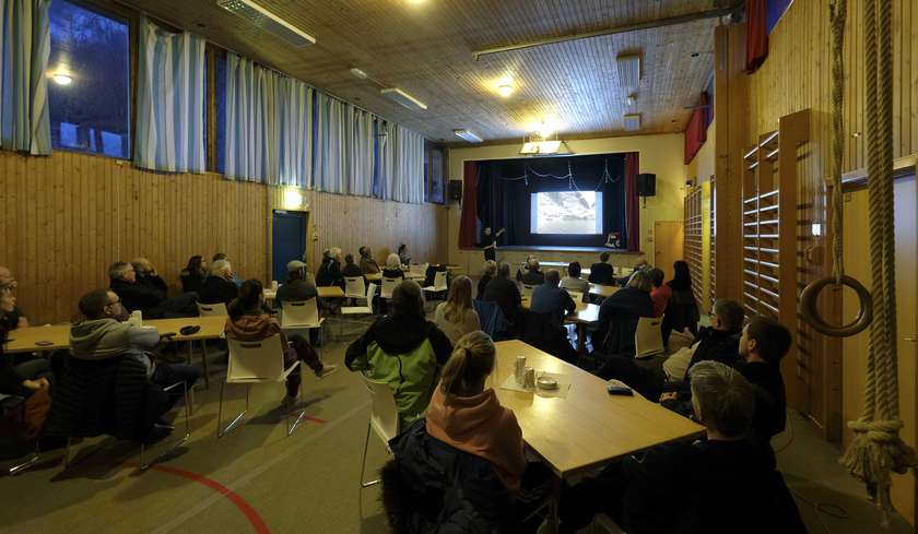
Discussing different scenarios for the possible development of Nordrepollen, Austrepollen and Sunndal with the towns’ inhabitants. Cards-on-the-table public presentations and vigorous debates are integral to 3RW’s planning processes: consultants, municipal agents and locals provide input and so inform the spatial strategy for the future of their homeplace. Legible and attractive graphics facilitate the exchange.
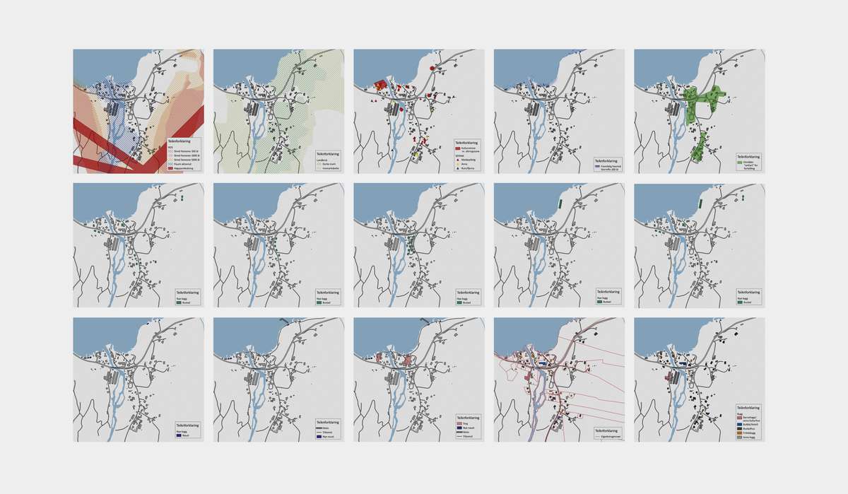
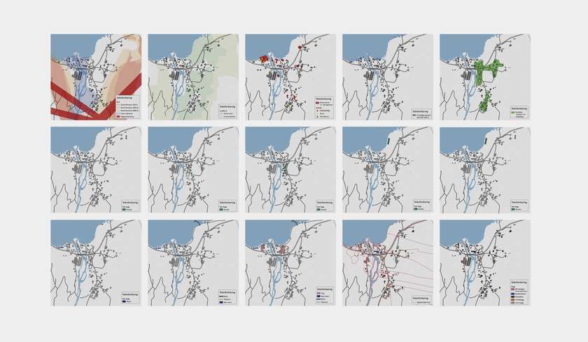
An extensive series of mapping analyses constitutes one of the first steps of the design and planning process, allowing for a much-needed holistic view of the different challenges and opportunities relating to the site. These studies become the framework for the development of speculative scenarios for the various villages.