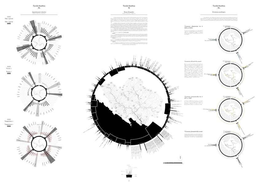
River landscapes represent a complex space-time process, shaping the surrounding territory in different ways and, at the same time, the environment. The design in this chase is the representation of complex processes that characterize river landscapes. The large amount of data and maps that were previously drawn were disconnected one from another, and presented themselves as separate layers. For this reason, the research has focused on how this information could be kept together in one image, thus stimulating a new understanding of the territory. The representation and the data are combined giving rise to circular shapes, where the shape suggests a previously lacking 360° degree spatial vision. The circle containing the map becomes at the same time the container and interface where the latent relationships between territory and quantitative data are shown. The representation is therefore transformed and acquires the ability to communicate a new identity.
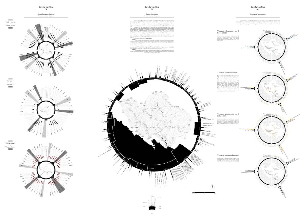
The “Synoptic Map of Hydrography”. Thanks to its circular shape, this map is able to highlight the complexity of the branching of the hydrologic system of the basin of the Magra river, thus describing all primary, secondary and tertiary tributaries. The comparison of the quantitative data concerning the width of the sub basins, the length and the average flow of the tributaries, with the drainage capacity of the “Landscape Units”, has highlighted the critical areas of the river.

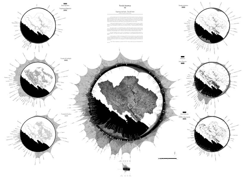
The “Synoptic Map of Land Use”, results to be one of the more complex elements that descrive the river basin, not only because it lists all the usage of the land that defines the immediate proximity of the river, but also defines what happens outside of that area. In this way we can comprehend how the information merging inside this complex territory, defines the constant evolution of the morphological and the anthropological factors that affect the river itself.
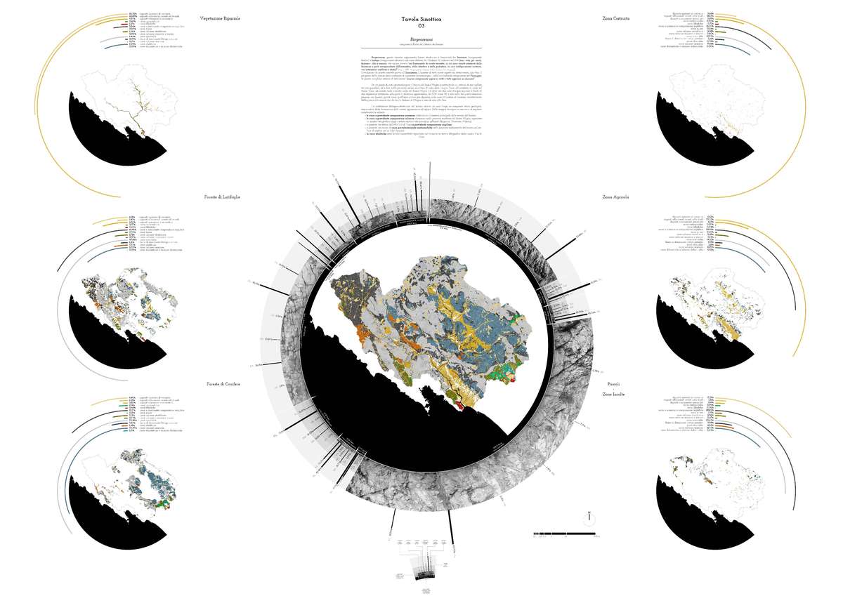
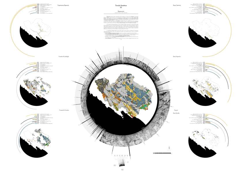
The “Biogeocenosis” is the link established between the Land Use and its plant cover, describing the places in two respects, which inextricably links the anthropogenic component to the natural one. This overlapping therefore demonstrates how the drainage capacity of the soil varies due to its being dependent on what the ground bears on its surface. Drainage capacity constitutes a key element in the description of the hydrogeological, perceptual and landscape instability of the river system.

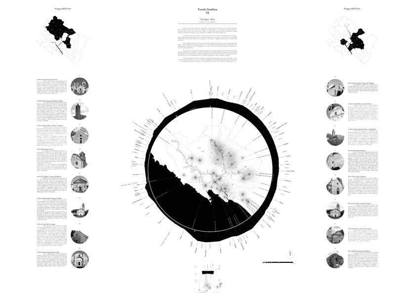
The “Synoptic Map of Sacred Streets, Churches and Hospitals” acts a link between past and present, thanks to its circular shape, this map is able to define how during time the pilgrimage defined and shaped the territory of the Magra river, generating not only new centers of religion but also consolidating the old ones. The external circle shows how this 3 Sacred Street pass thought the basin of the Magra river, combining themselves to the environment and landscape, describing the territory.
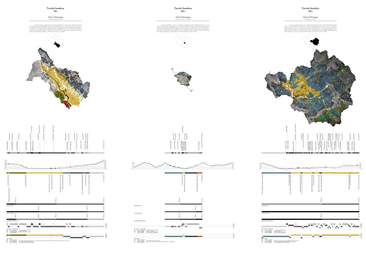
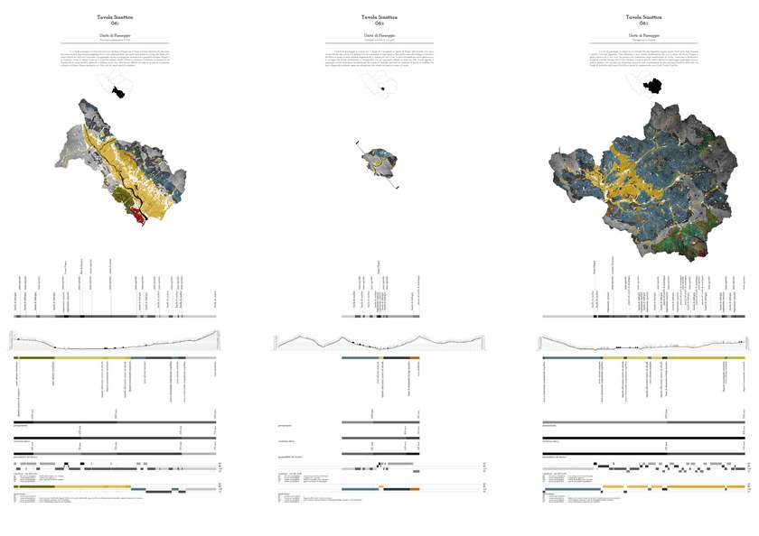
The 6 “Synoptic maps of the Landscape Units” were subsequently designed, allowing for an in-depth investigation of the landscape and morphological traits of the territory. These characteristics have configured the definition of the term “Landscape Unit” as “measuring unit” of a territory that features physical, biotic and anthropic homogenous traits. This characterization and analysis have been studied through the use of geographical sections, which have a constant size of 2,780.00 m.