Refugee camps are transitory solutions that, as they endure, end up becoming informally constructed cities with a strong negative imprint on the local environment. The supposedly temporary nature of refugee camps and the limitations of humanitarian organizations who have a mandate to save lives but not to plan for the presence of refugees in a country – often mean that the refugees themselves live in a state of limbo with a limited ability to affect their living environment.
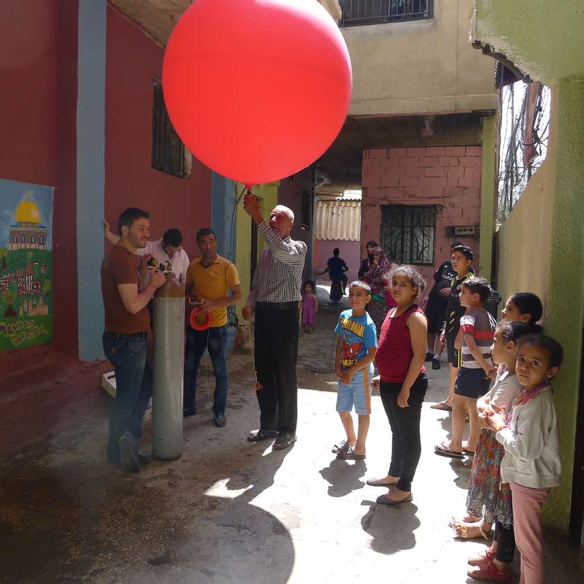
Balloon mapping is a citizen science tool that can support refugees in this endeavour. It is a “DIY aerial photography tool” that we have been using at Bourj Al Shamali refugee camp in south Lebanon. The low-tech aspects have enabled a wide participation of members of the community, as well as being a playful and poetic way to map the refugee camp.
Spatially understanding refugee camps that have been in existence for more than 50 years is critical for the future of architecture.

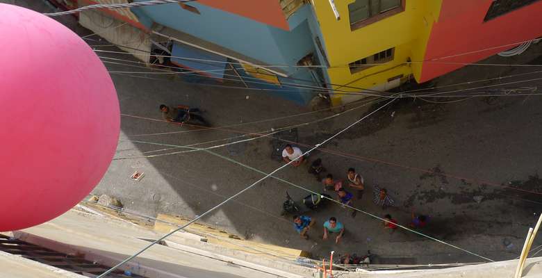
Crowds gathered to see the balloon that mapped Bourj Al Shamali refugee camp in south Lebanon.
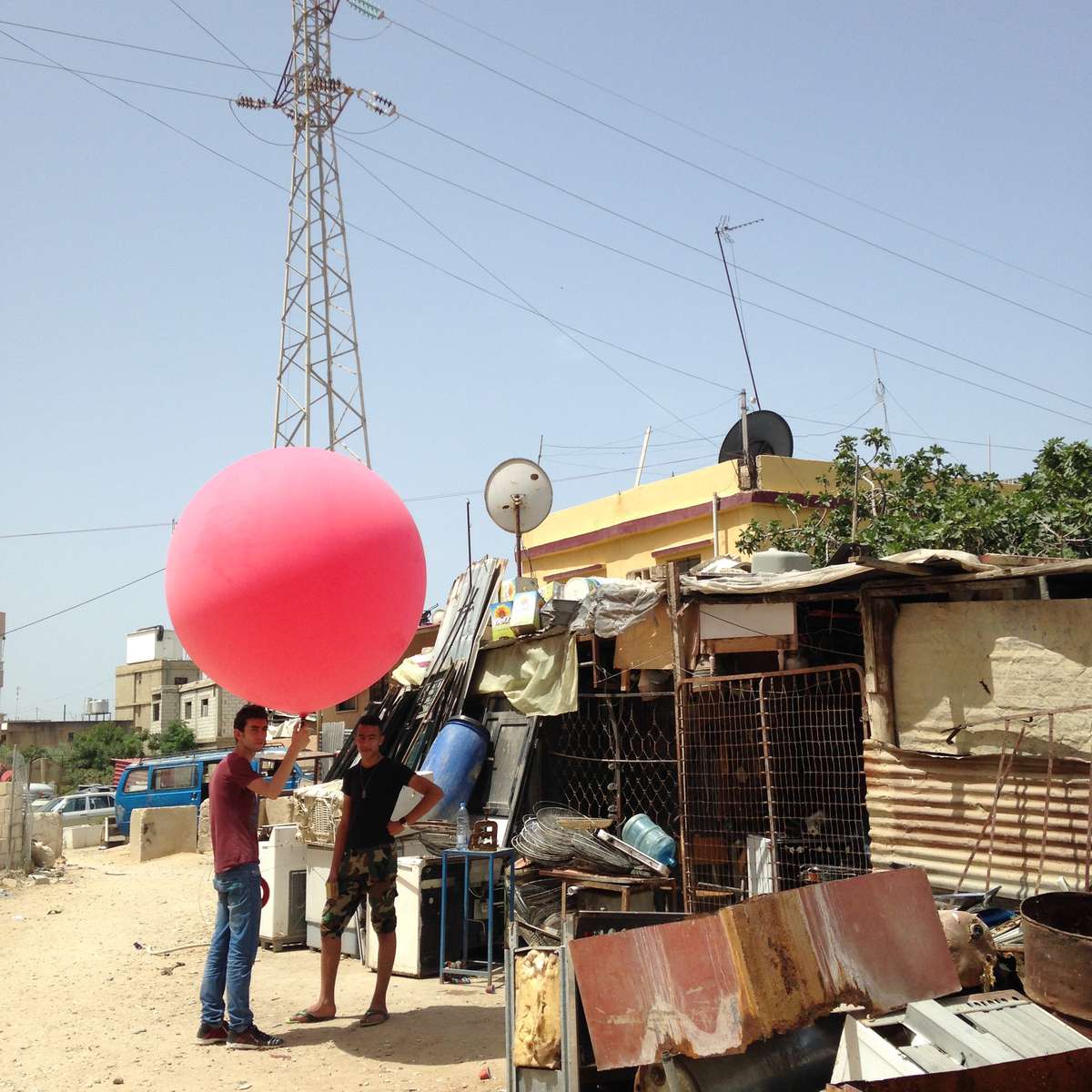
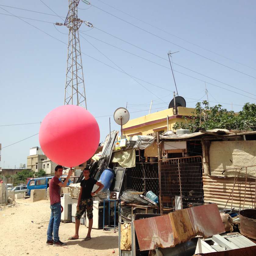
Firas Ismail and Mustapha Dakhloul ready to map their camp.
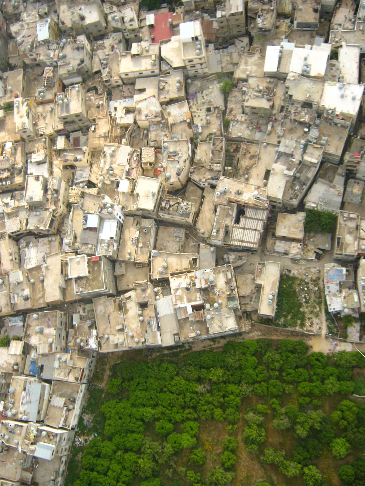
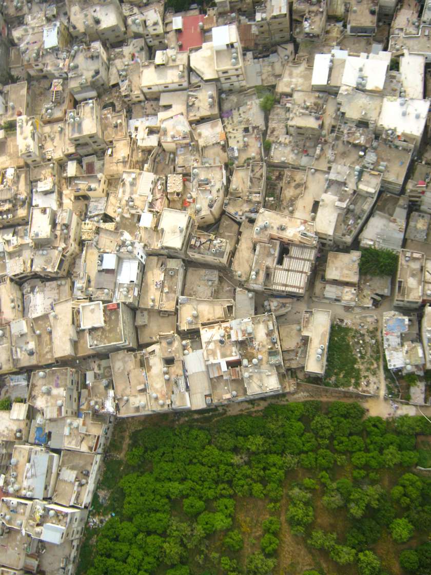
Aerial images of Bourj Al Shamali from the balloon.