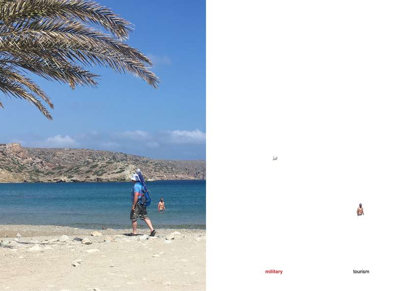
- Site-specific cases
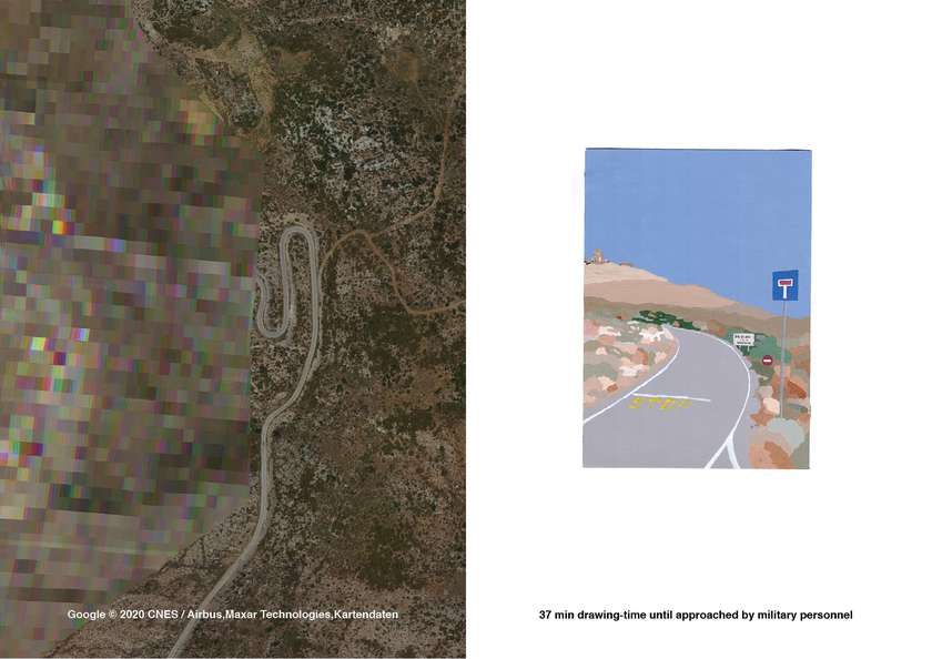
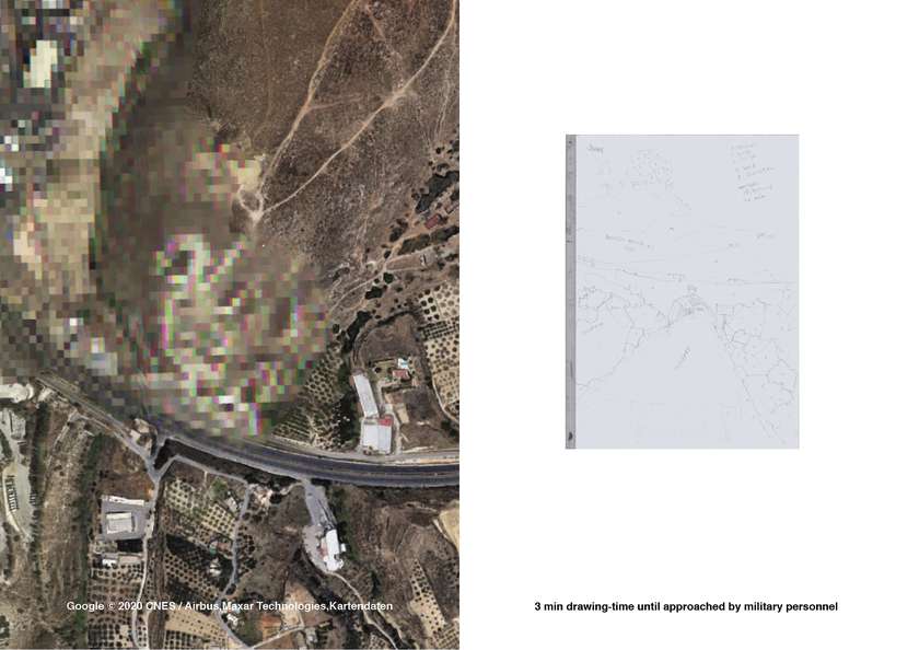
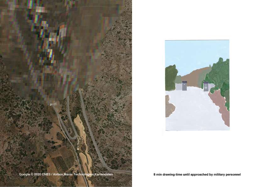
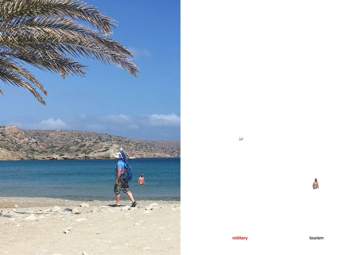
„It is a mistake!“ I said, pointing to the Greek letters written on a map I got from the car rental. Agios Isidoros Beach it said there, but the guarding soldier that came storming out of his shelter as soon as he got aware of me, shook his head and explained in detail, why I was wrong. Unfortunately I can neither speak nor understand Greek but I knew already, that the map was not a precise representation of the conditions of Crete's northeast peninsulas. Two weeks ago I had stumbled upon these landforms using a way more accurate map, google earth, which was all of a sudden blurry, pixelated, and that on purpose. So while on vacation, I wanted to see what was not to be seen by me. Coming across signs that state the military restriction and prohibit taking photographs, I tried to capture a visual representation of what should not have one – by painting it. That was when I was approached by the guard and had to do my best impression of a German tourist, before being asked to leave.
Landscapes have always been superimposed by humans: Populated with cities, cultivated for agriculture, windmills for electricity, excavations for archeology, promotion for tourism. All these uses are visible through their specific spatial expressions, to which we became used to and already start missing, when they fail to show: sunscreen on water, overfilled trashbins at ancient sites, queuing cars and many more anthropogenic objects make their way onto our holiday-photos and by that into our m–

emory. Nevertheless, they are at core grasps of power and control and the access exercising its dominance the most is the one by militarization. The architectura militaris of the early modern age was developed in close dependence on the developments of artillery. Ballistic measurements soon formed architecture that could no longer be attributed to the city, because of its sheer scale and entirely different constitutional logic: the weaponized architecture formed its own spatial language. Milita–

ry control is being exercised in a very different way today, as developments in aeronautics, missile and radar technology have relocated the questions of power from land to air. Fortifying actions now form spatial bodies that impose control by identifying aerial actions and therefore maintaining sovereignty. The linearity of the fortress wall dissolves into singular points – radars, that together form a net to gain a continuous documentation. As these radars are military bodies, they form restr–
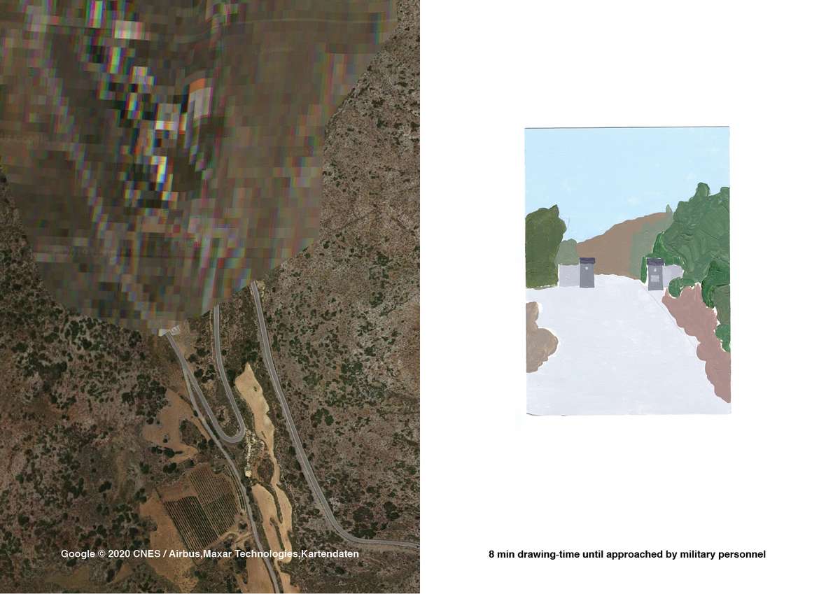
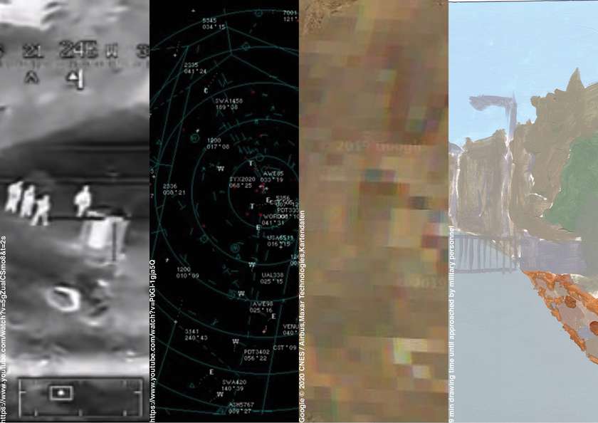
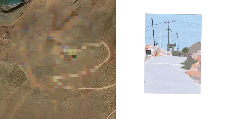
icted zones around them. Within these detached territories divergent laws of time and space apply and new distinct pattern of behaviour are expected. To protect them from recognition and access by alien institutions these areas are masked. What is done through analogue camouflage, denial of admission and photography gets a digital equivalent: the pixelation of the otherwise perfect satellite images, google is providing. But still, there are visual representations, formed by the machines working
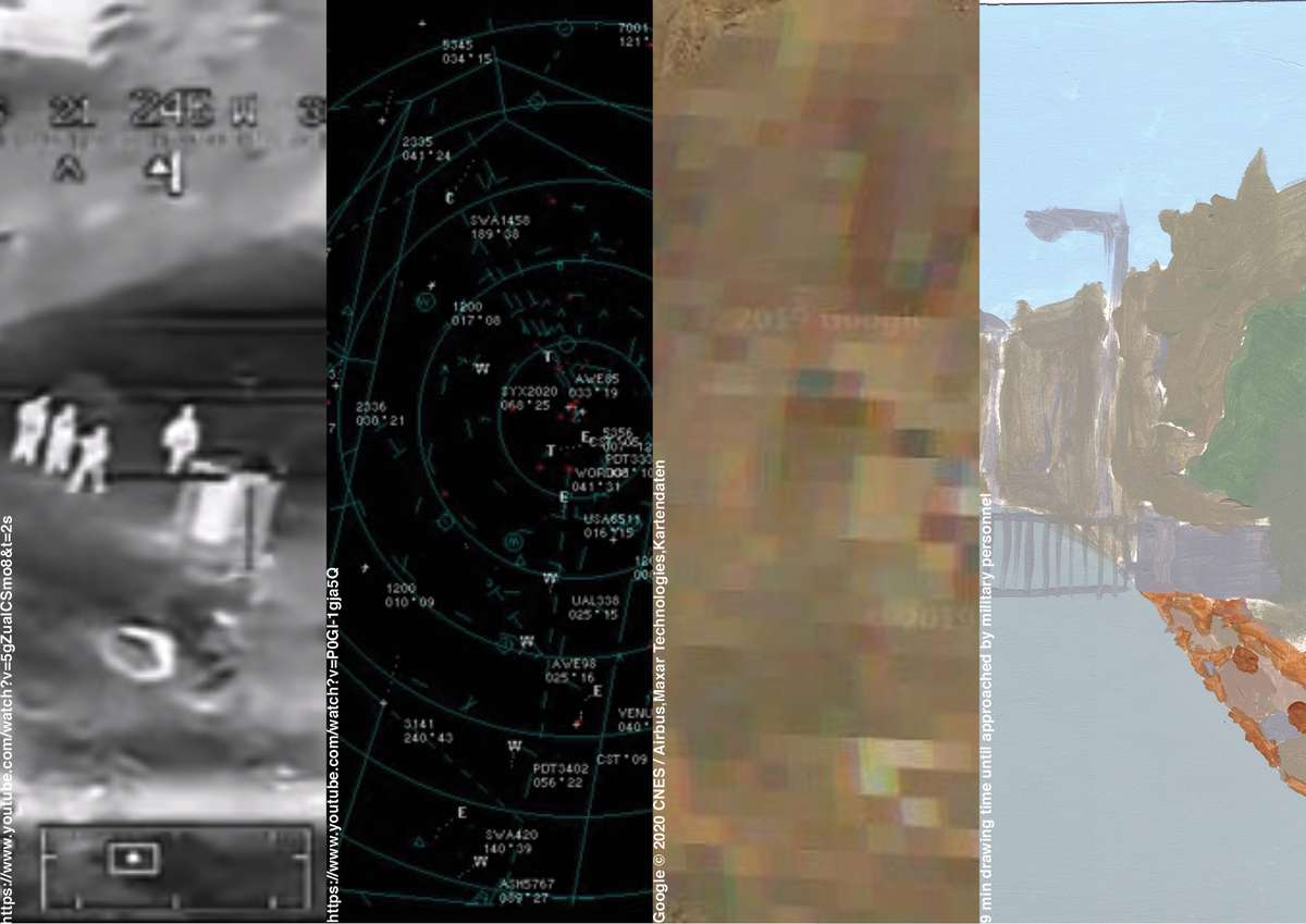
within these zones. They distort the image into seemingly objective techno-scientific facts: grayscales and numbers. If access and visibility is limited, who is then deciding on the validity, impact and interpretation of the narratives of certain spaces? This work aims to claim a part of authorship and emancipation in the handling of spatial stories. New narratives shall be formed, adding to the preexisting ones, this time emotional and subjective, with writing and image, text and color.