The outdated rural-urban dichotomy, recent questions of scale, potentials of planetary urbanism in Anthropocene demand the immediate implementation of critical tools and new approaches in order to understand and design cities. Walking the Map Mapping the Walk proposes to explore northern regions of Istanbul with a dual focus. While one focus is the personal view of walking through ‘actual territories’, the other one is the view achieved by looking at these territories from above (maps, drawings, aerial and satellite images). Therefore, ongoing transformations occurring due to the construction of Northern Marmara Highway are investigated by walking around the highway’s route, looking at it from an aerial distance and finally mapping the area by superposing both views. Walking the Map Mapping the Walk argues that simultaneity of both perspectives has the potential to bolster the necessary leap in research, design and architecture of city.

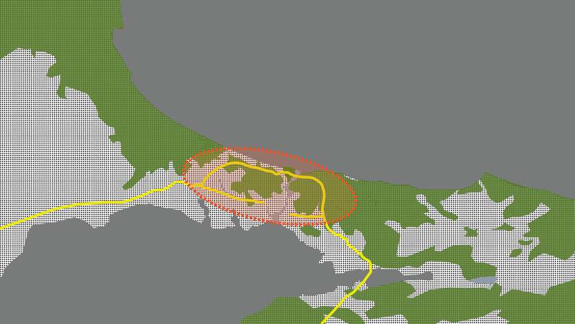
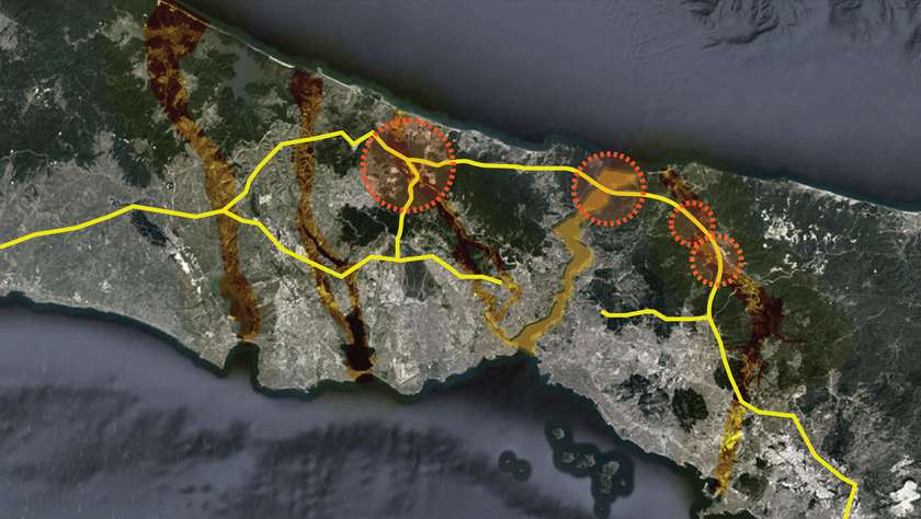
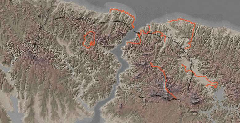
Northern regions of Istanbul accommodate forests, agricultural fields, quarries, water basins and floodplains. These natural and manmade geographies are essential for the city’s natural reserves, ecological well-being and urban social life. Walking through these regions and looking simultaneously to them from above could offer a unique perspective to recognize the area at large, understand the impacts of infrastructural operations and propose design strategies and scenarios for the future.
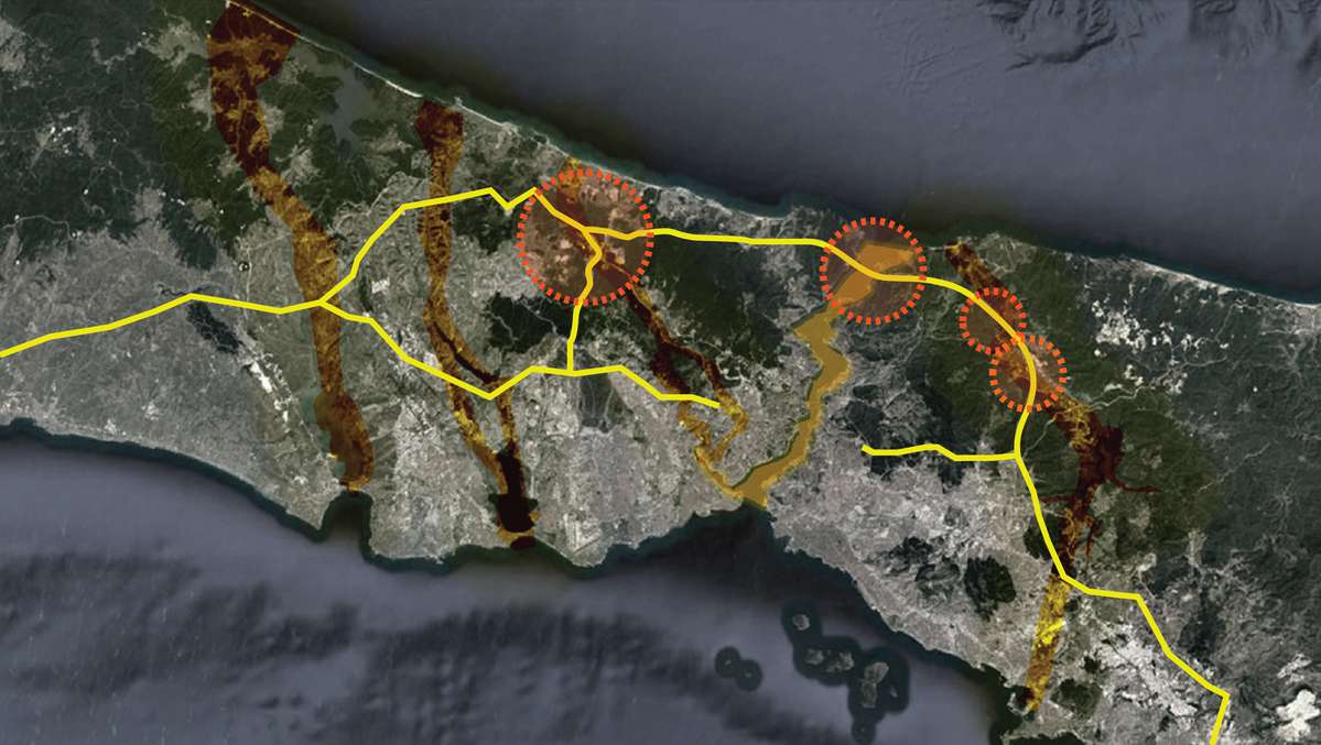
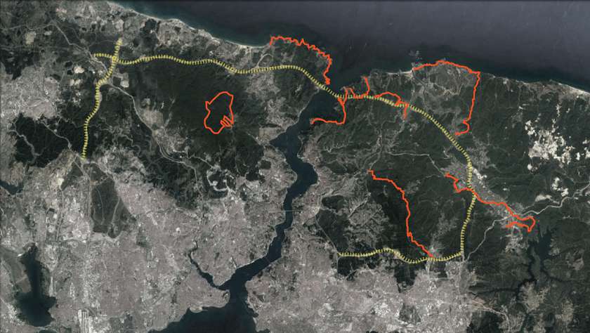
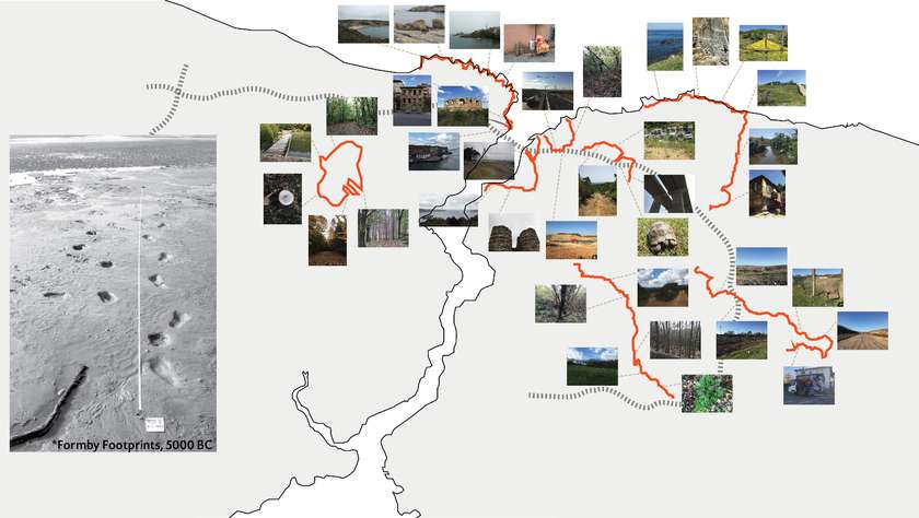
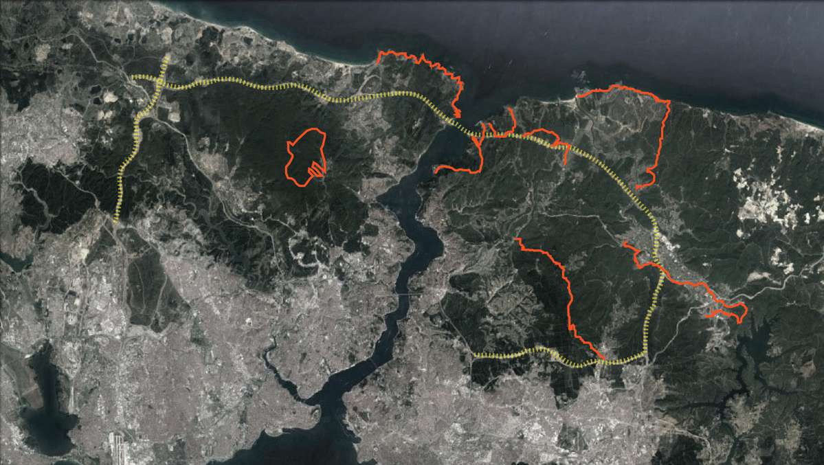
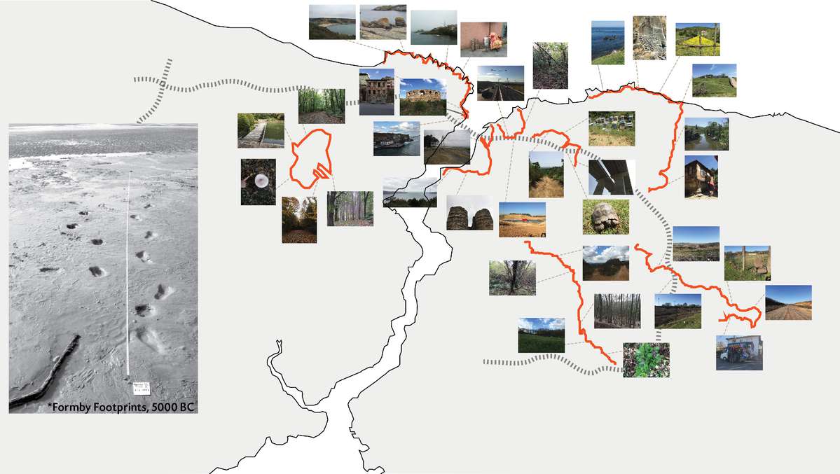
The route of the Northern Marmara Highway nestled in Northern Istanbul is explored through the multi-sensual and personal experience of walking: ergo Walking the Map. The interactions between the infrastructural corridors that are imposed upon the existing ecological corridors (water basins, rivers, Bosphorus etc) of the city are investigated through these walks. Consequently, the transformations experienced by natural and manmade geographies are perceived and documented.
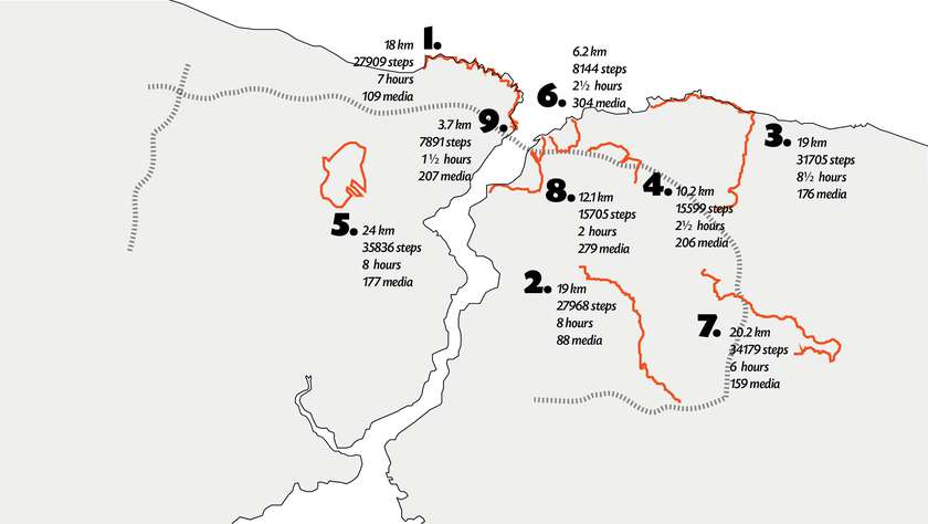
The experience of multi-day walks are recorded through photographs, videos, field notes and cartographic diaries. Eventually, the routes traversed are represented in maps; ergo Mapping the Walk. The physically and virtually nomadic way of exploring and representing the city triggers a discussion about ‘rural’ Istanbul, an area currently open to speculation due to recently constructed transport infrastructure. This discussion establishes a position of resistance and transparency for the city.

The walks that are done on and around the Northern Marmara Highway are performed alone or with other groups (Hiking Istanbul etc). Through the reconciliation between the scales of the walking individual and the aerial perspective, a platform of discussion for the possible futures of the architecture of the city is created. Since the walks are still continuing, the platform is constantly growing and being updated.
Walking per se is taken as an aesthetical and architectural practice since treading on Earth concurrently transforms its surface. No matter how minute and transient is the scale of walking body next to the colossal scale of transport infrastructure, its impacts are articulated to the anthropic layers of the planet. Combining walking with the distanced aerial view in order to map the exemplar of northern Istanbul could enable a unique perspective to perceive, explore and design the future city.