Human behaviour on territory has had a great impact on the geophysical processes in last centuries, creating a new geological epoch: the Anthropocene. The environment exploitation in favour of productive sectors supposes an impoverishment of natural systems and debilitates biological relations. That generates a serious risk of desertification.
Therefore it becomes necessary to define a new paradigm which achieves a constructive engagement between technology and nature. A concept that reduces the pressure on the environment and increases our ability to anticipate.
Agriculture is the main cause of the Anthropocene, nowadays between 40 and 50% of the Earth's land surface is considered cultivated. This is the case in Guadiana River Basin, where agricultural use has increased dramatically in the last 40 years. The repercussion of that exploitation has carried the disappearance of many wetlands and its biodiversity, so it becomes necessary a plan to recover the territorial identity.
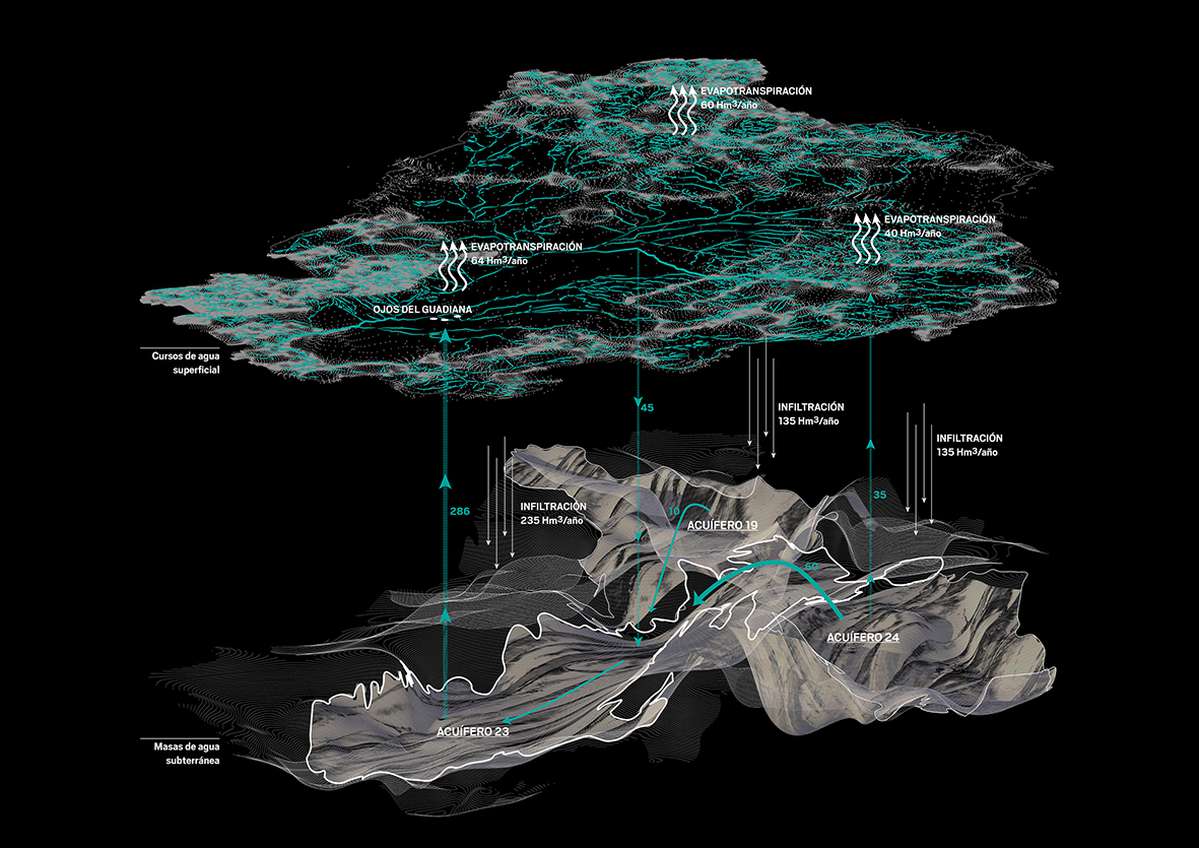
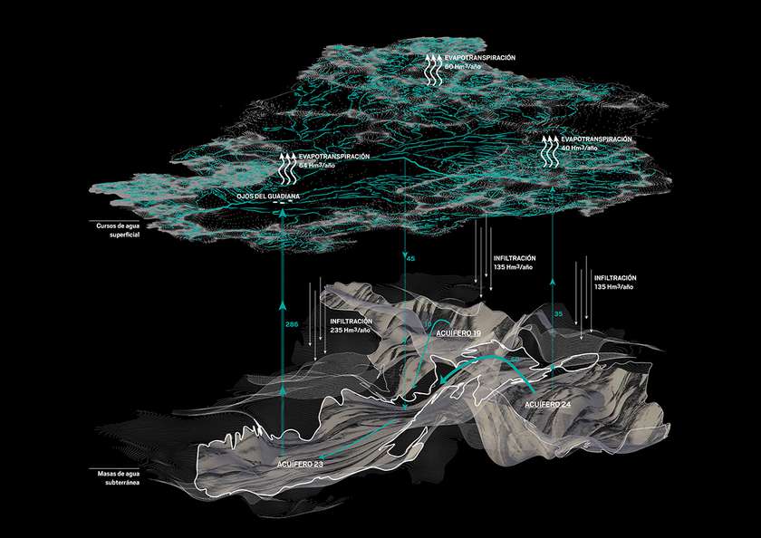
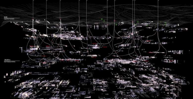
This territory presents the particularity of having strong ties between superficial and underground waters. These hydrological relationships are complex and fragile, and they depend on seasonal variations and on human resource exploitation.
The Cuenca Alta contains dozens of wetlands that appear and disappear according to the raises and descents of the groundwater level. This is due to the high permeability of the soil, composed by limy deposits, and to the absence of topography.

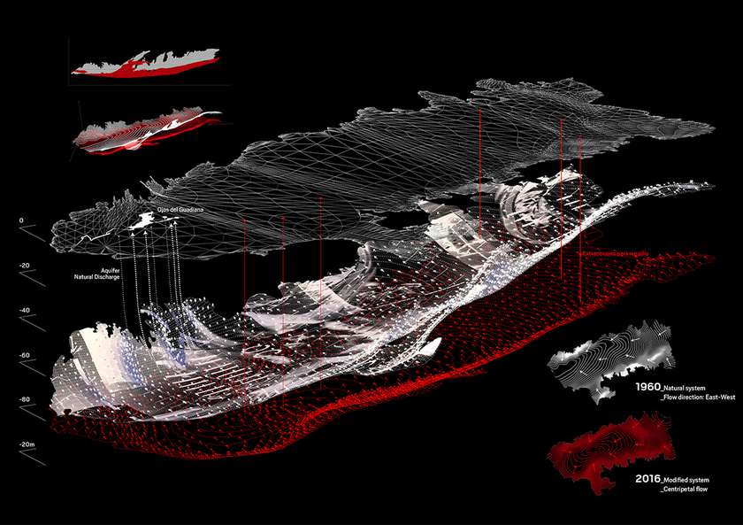
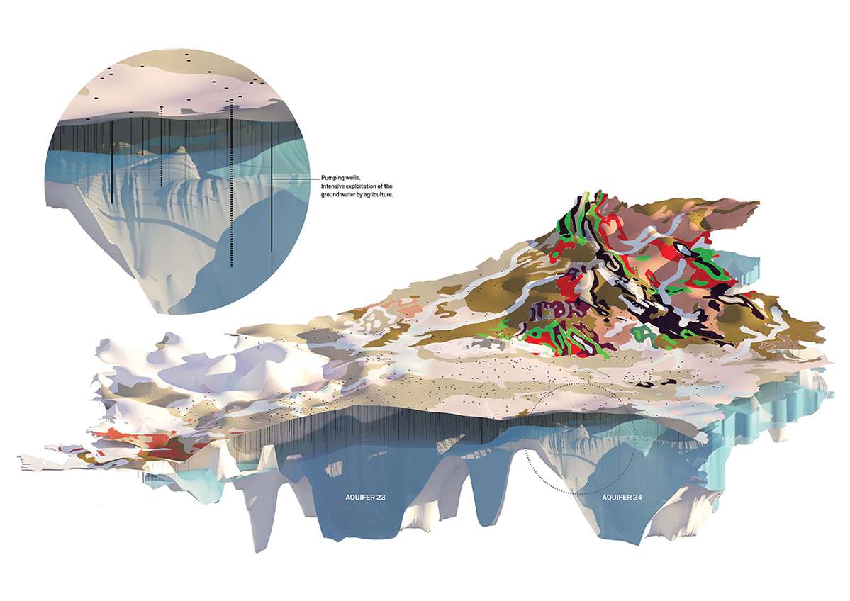
In the last decades, ground-water extraction has become widespread, and its use for irrigations has reduced deeply the Aquifer 23 reserves, and has modified its natural system.

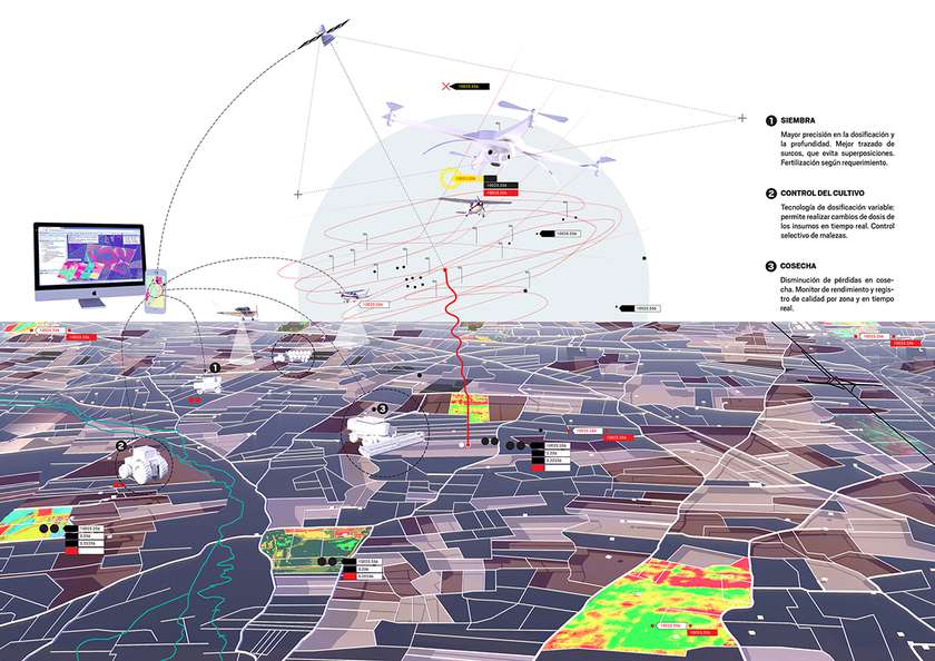
#Smart strategy seeks to shrink the cultivated surface, by the introduction of advanced management and systems based on information. That allows the optimization of energy and resources and the sophistication of the agrarian processes.

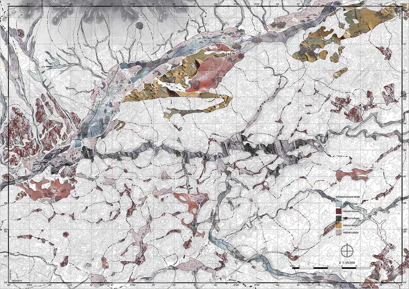
#Rewild strategy gathers the areas yielded by agriculture and incorporates them into a green animated infrastructure, in constant expansion thanks to biological powers. It consist of strategic revegetation actions and forest islands creation. These areas have a great potential for the passive renaturalization.