- Systemic changes
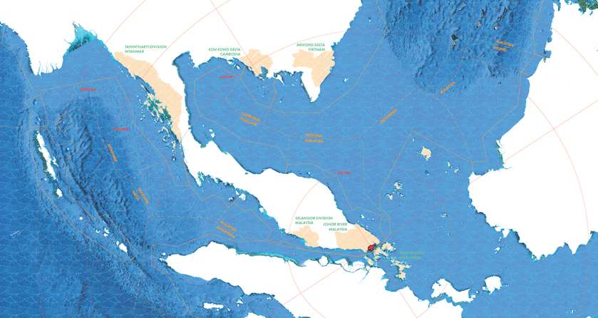
Territories of Territory Extraction explores the Singapore Strait: a unique geographical pressure point in the international sand trade, an area where the intersection of economics, environmentalism, and geopolitics is made manifest through architecture. Singapore is the largest global importer of sand, using aggregate for landfill, infrastructure, and cultural projects to maintain the city-state's high standard of living and international influence. Territories of Territory Extraction proposes a living map of the sand trade in the Singapore Strait, creating a resource that cross-references and tracks past and future geopolitical and spatial changes. The project looks forward, interviewing experts in architecture and material science, creating connections and proposing alternatives to sand-based construction in the region and beyond. Territories of Territory Extraction examines a future that has arrived ahead of schedule, laying the groundwork for architecture in an era of scarcity.

Singapore’s sand extraction hinterlands in Southeast Asia. As of 2018, Indonesia, Malaysia, and Cambodia have all banned exports to Singapore.

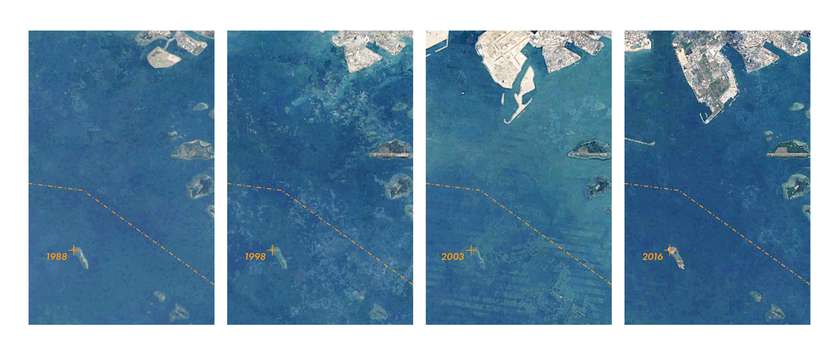
Indonesia’s Nipah Island is dredged beneath the waves. As it slipped beneath the low-tide mark, Indonesia re-dredged the island to its present condition.
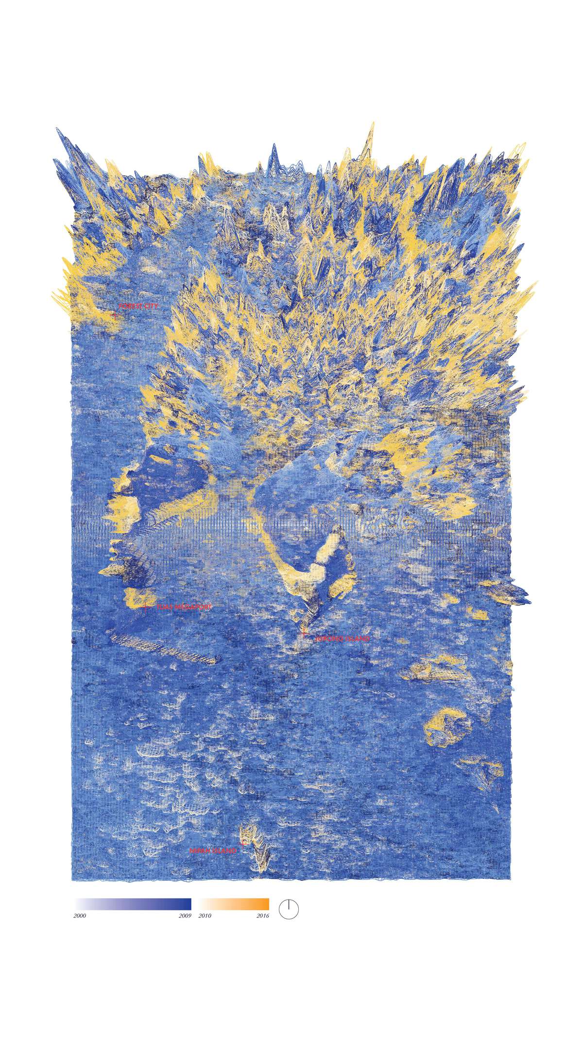
Chronological Topography, Tuas Megaport and Jurong Petrochemical Facility, 2000-2016. Nipah Island (reconstructed) appears in the south.
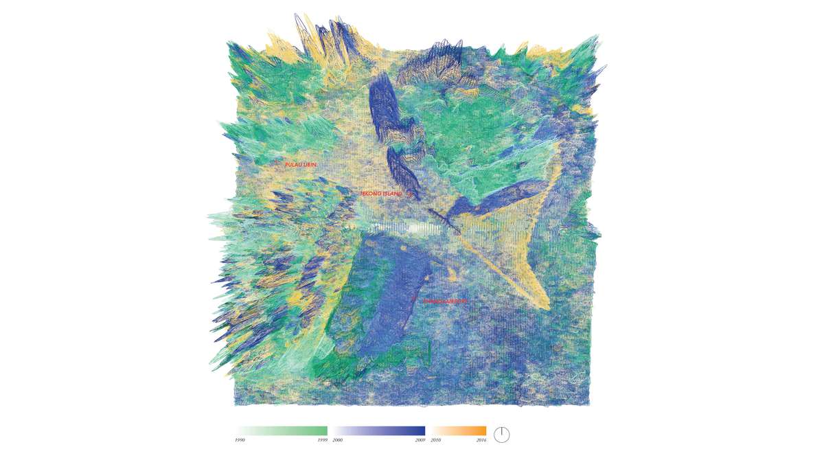
Chronological Topography, Tekong Island and Changi Airport, 1990-2016. Changi Airport’s expansion is being designed by KPF and Thomas Heatherwick Studio.

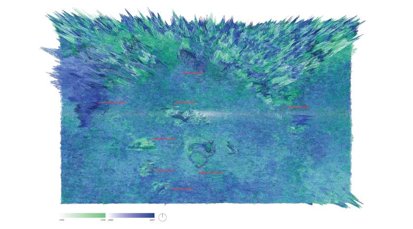
Chronological Topography, Pasir Panjang and Singapore Strait, 1990-2009.