- Systemic changes
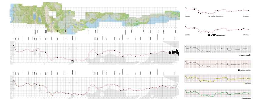
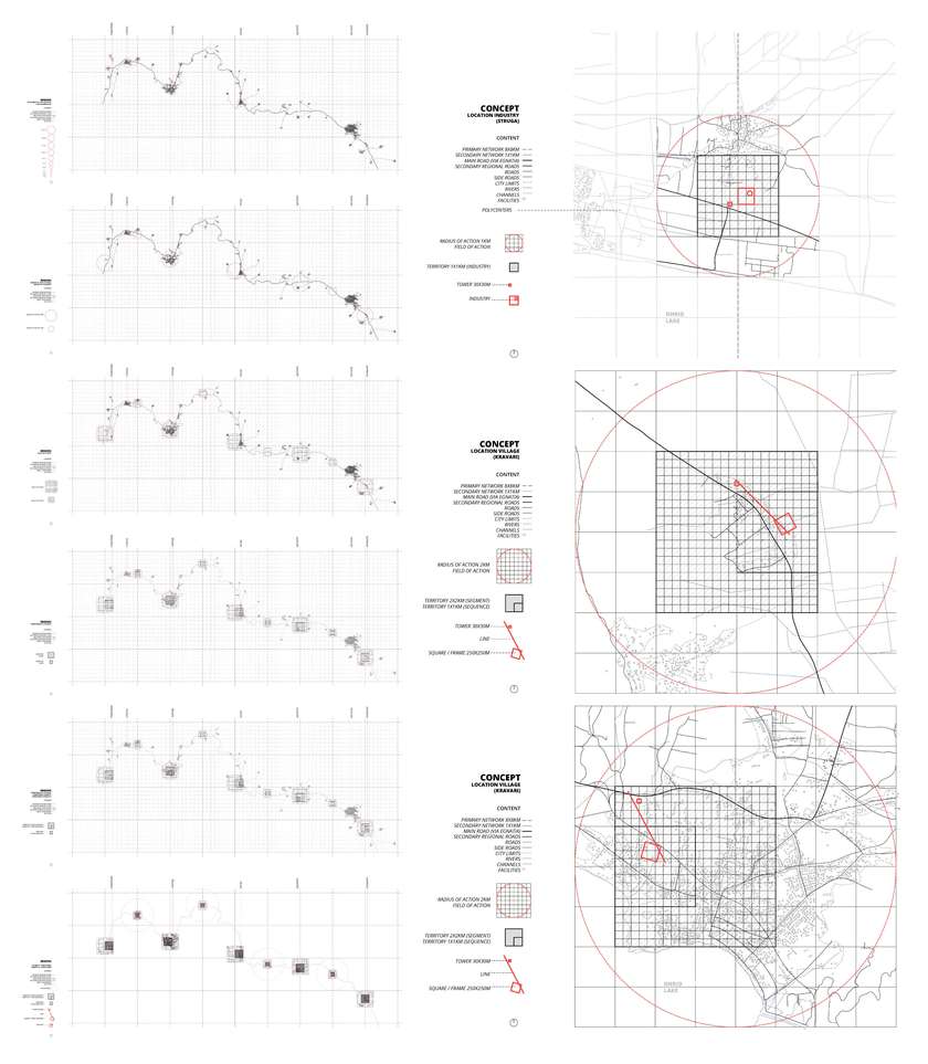
The southeastern part of Europe is affected by the trend of emigration on the population, and a depletion of intellectual capacity. Can this situation push the boundaries in many areas of everyday life creating a new vision for the city? City, set on the route of road Via Egnatia, stretching from Durres to Istanbul connects and changes borders of 4 neighboring countries. Program is envisaged to take place at certain points as a future potential for a new linear continuity. Revitalization of urban units in peripheral regions, cities borders, integration and formation of global dynamic zones, creates balanced urban and dynamic zones of economic integration, as new polycentric European and Balkan city. In terms of territorial and spatial disposition, 3 different elementary formations are generated, establishing dialogue with the geography and the artificial. Tower, square/frame and line. Their positions change depending on context, having the same concept adopting to the given conditions.
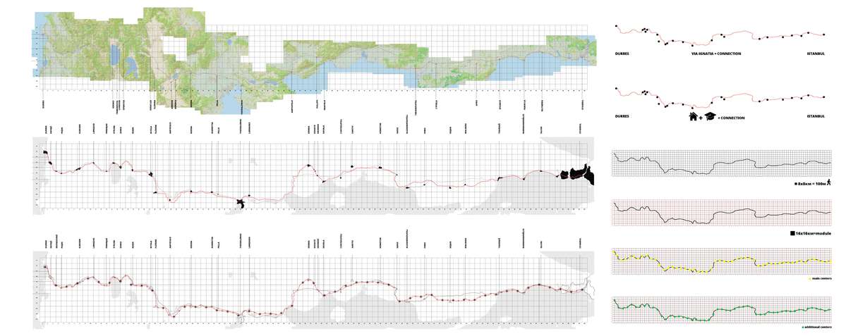
Durres and Istanbul is not only an infrastructural issue between the cities, but also the connection of two port points that are at different ends of the Balkan, the merging of two seas, moving the borders of 4 Balkan countries. Will this hypothetical line keep the population from fulfilling all the shortcomings, led by the new community, and will it set new lines of action for a new settlement on the territory? Can the attractiveness of the line be restored globally?
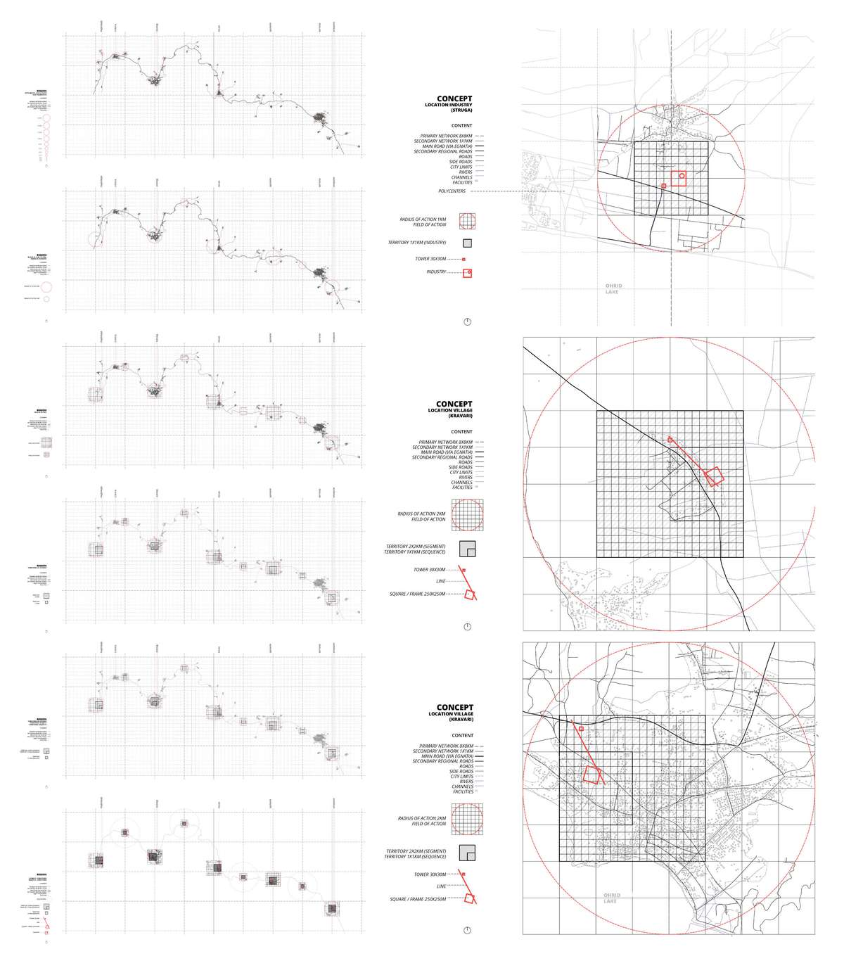
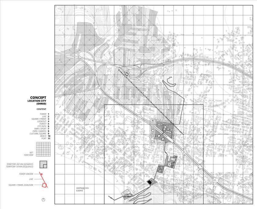
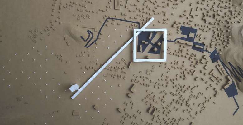
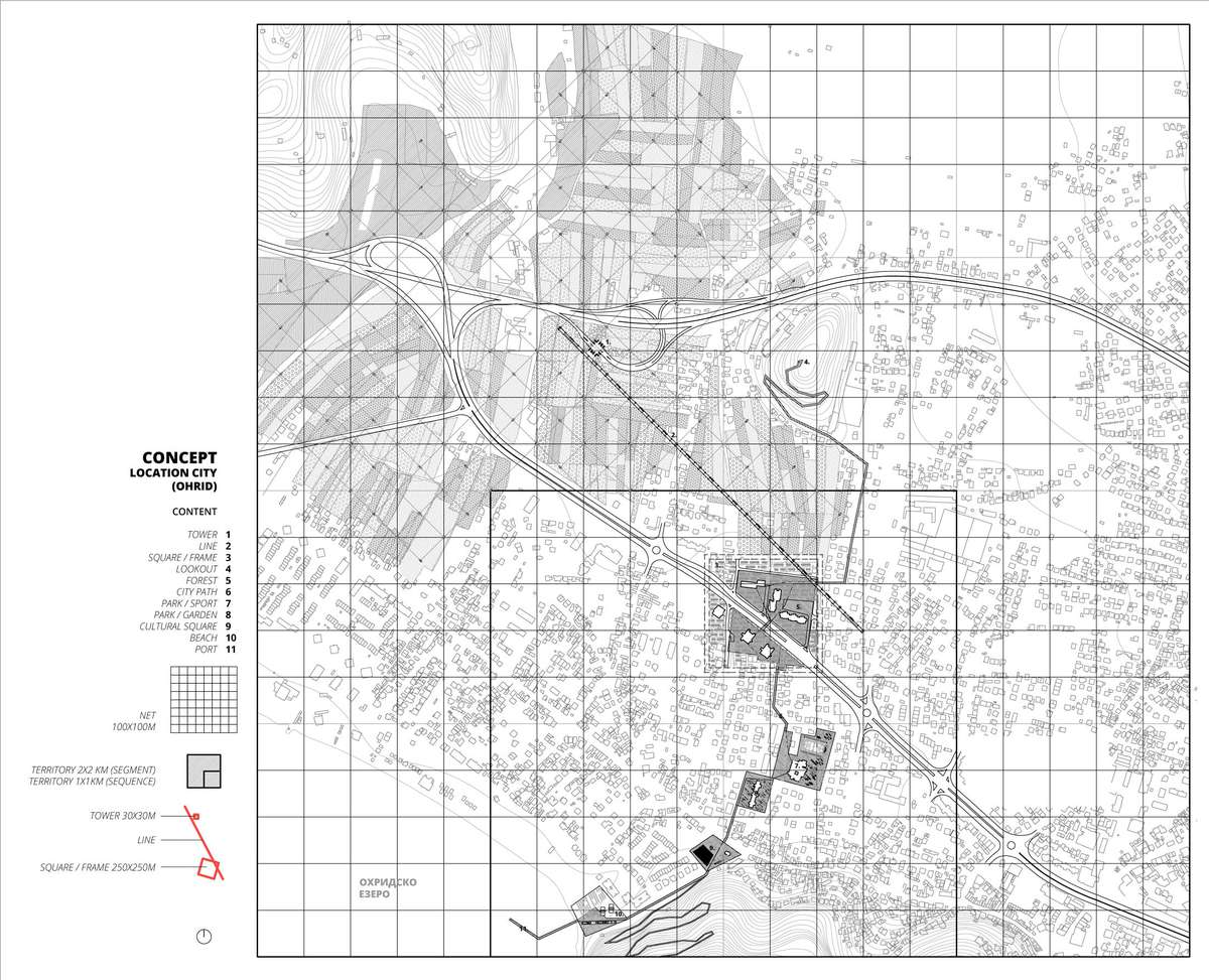
Three spatial elements are defined that generate different formations in terms of their territorial and spatial disposition. Through them, a dialogue is established with the geography and the artificial. Tower, square (frame) and line. Their positions change depending on the situation, but the concept is essentially the same and only adapts to the given conditions. Part of the territory with dimensions of 2x2 km, covers most of the territory that will be operated.
In order to act on the physical context which has many different states, and to neutralize the inconsistencies in it in order to make the environment more coherent, some specific parts of the territory are selected and some attempts at spatial projections are made on them. What is urban and what is rural?
It is a topic that plagues the largest and most densely populated cities. Is it a city, a city, if there are still rural areas that are scattered around the edges?
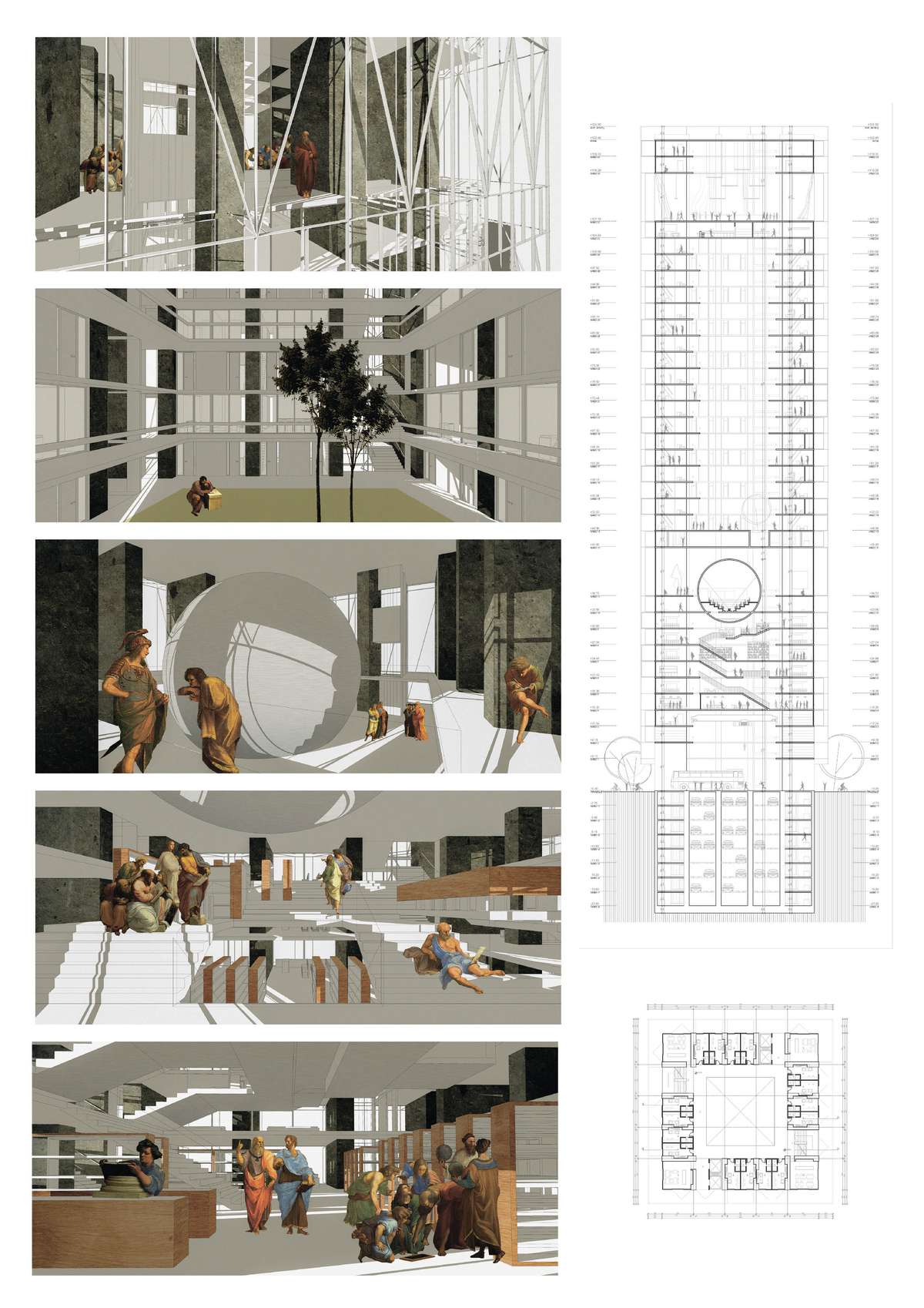
In the specific example that has been taken for development, the first element that is located next to the road that connects all the centers at a distance of 16 km, is the vertical, ie the tower. It should be part of the infrastructure and be available for fast transport. It should be one of the points where people would transit. The program housed in it should be temporary housing and faculty and research premises. All towers should represent one program segment, ie one university.
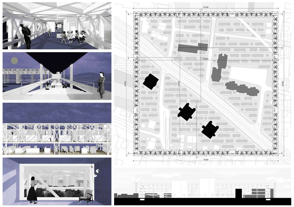
The concept of the square is to frame a certain territory. The square is 250x250m, and it is placed on the edges of the city. At the edge, where the city is not defined by a strong urban structure and where the rural area begins, some natural landscape or arable land. It should programmatically supplement the housing, increase the percentage of population density, and thus respond with additional content that would animate the residents, to become an additional center in the city morphology.