- Systemic changes
Answering to the most recent inquiries regarding the need of more radical climate adaptation strategies, the project aims at managing processes of change in infrastructure design, implementation and maintenance.
New to design the next generation of integrated blue – green – grey infrastructures is taking into consideration deep levels of uncertainty, which consequently asks for innovating governance processes. In the project this will be done by focussing on: 1) how to re-conceive the infrastructure space and its specific definition; 2) how to define and program infrastructure performance and operation under environmental extremes in both tactical and strategic ways.
It generally explore the architecture and cultivation of regional land/waterscapes—as a novel or possible approach to infrastructure and public works.

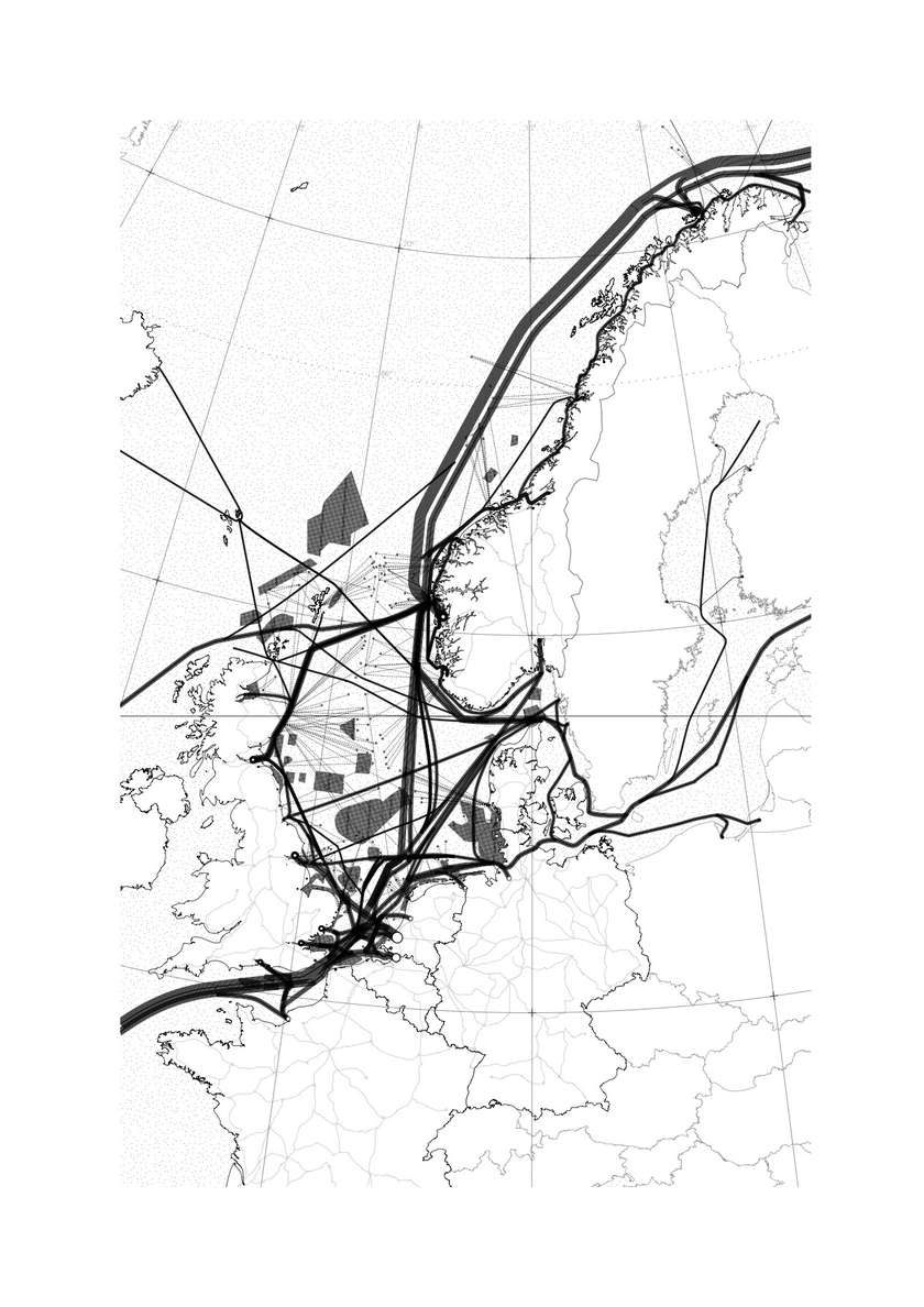
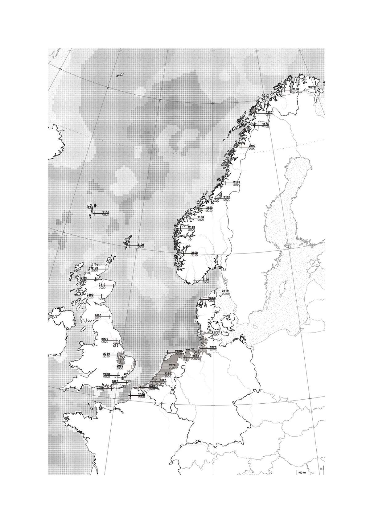
As a first part of the analysis of the north sea in its altered condition, the map shows the projection model for logistic flows in 2150 in the North Sea. Dredging of the major harbors in the South is not feasible anymore. New cargo and vessel transfer ports are now located towards the North in Norway. With the opening of the North Arctic Sea route, new ports were openend into the sea on the edge of the fjords where the waterbed is deep enough for future ships.

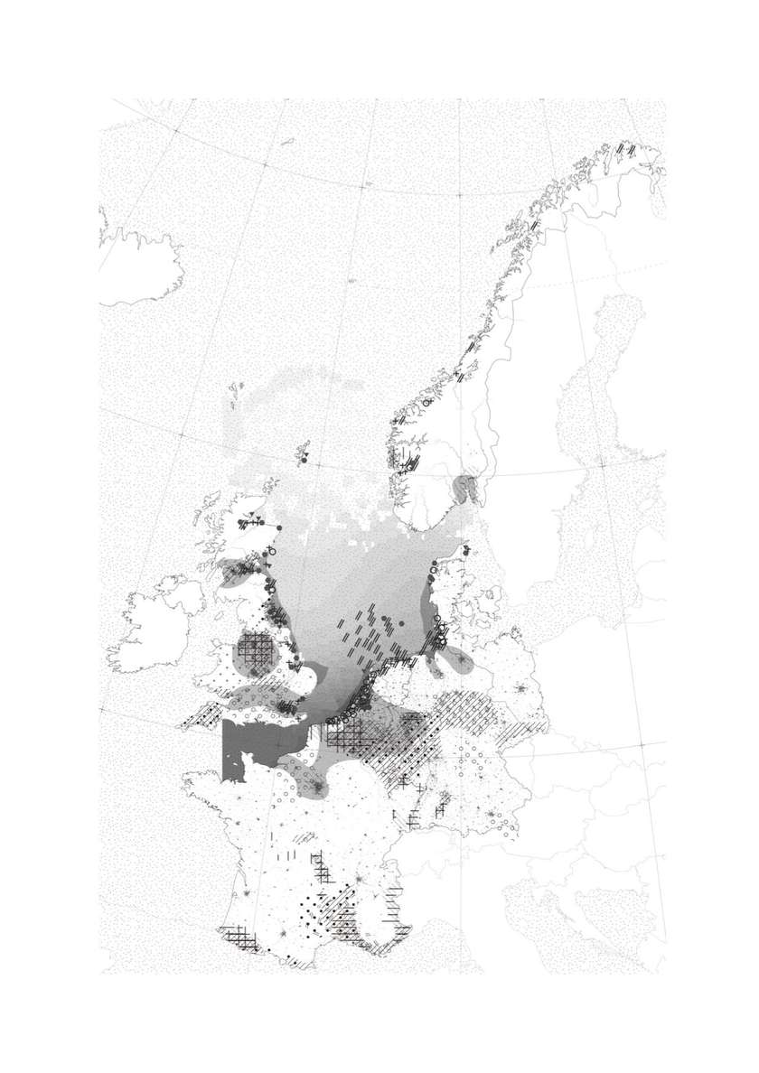
As a first part of the analysis of the north sea in its altered condition, This map illustrates the areas where different heavy metal, PAH and PCB contaminations are concentrated. It also includes the concentra- tion of plasic items on the North Sea
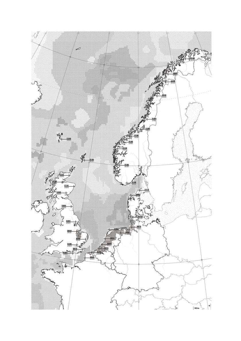
This maps illustrates the extreme effect of the climate change in case of +1m sea level rise (SLR) in regard to 8.5 RCP scenario and in the absence of action. The sea projection depicts a prediction for the relative sea level rise in the period 2081-2100. The map renders the flood risk areas in the North Sea region and provides information about when those events are expected to be formalised: as extreme event (Flood) or constant condition (Sea Level Rise).
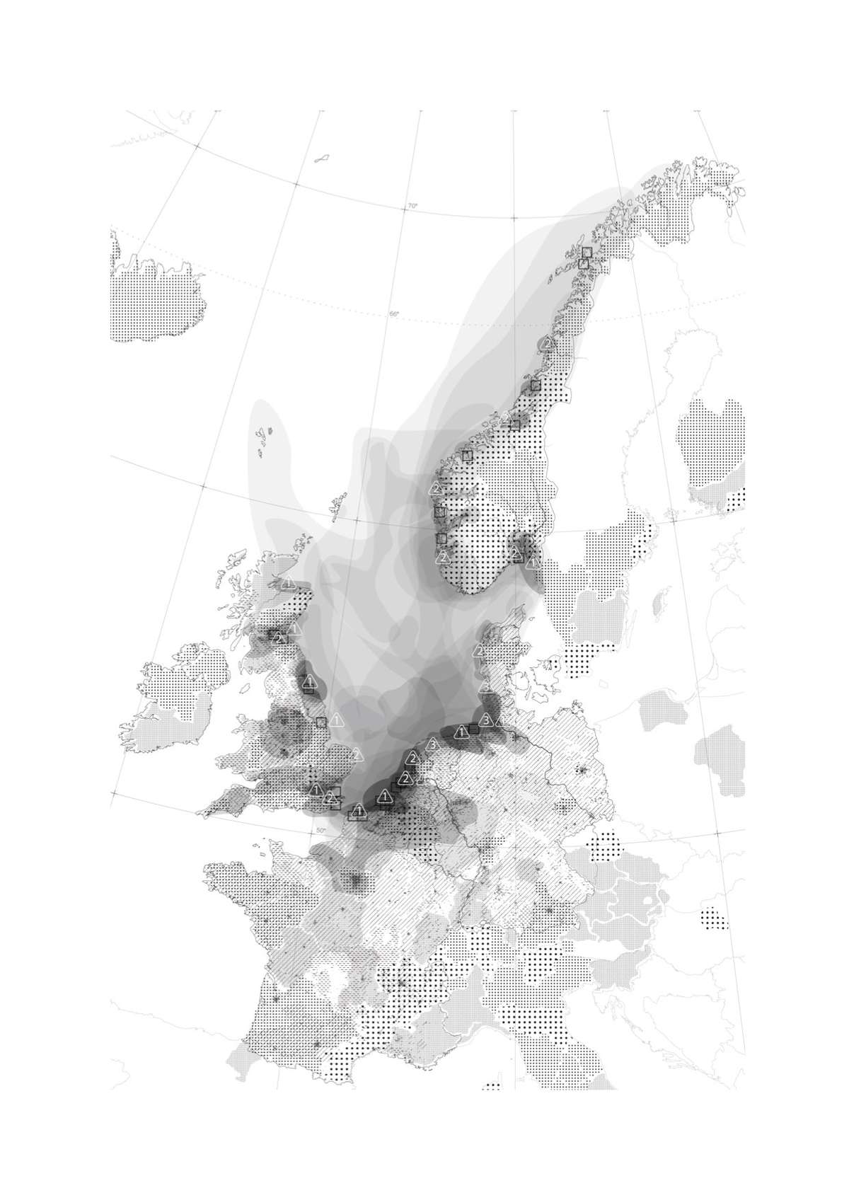
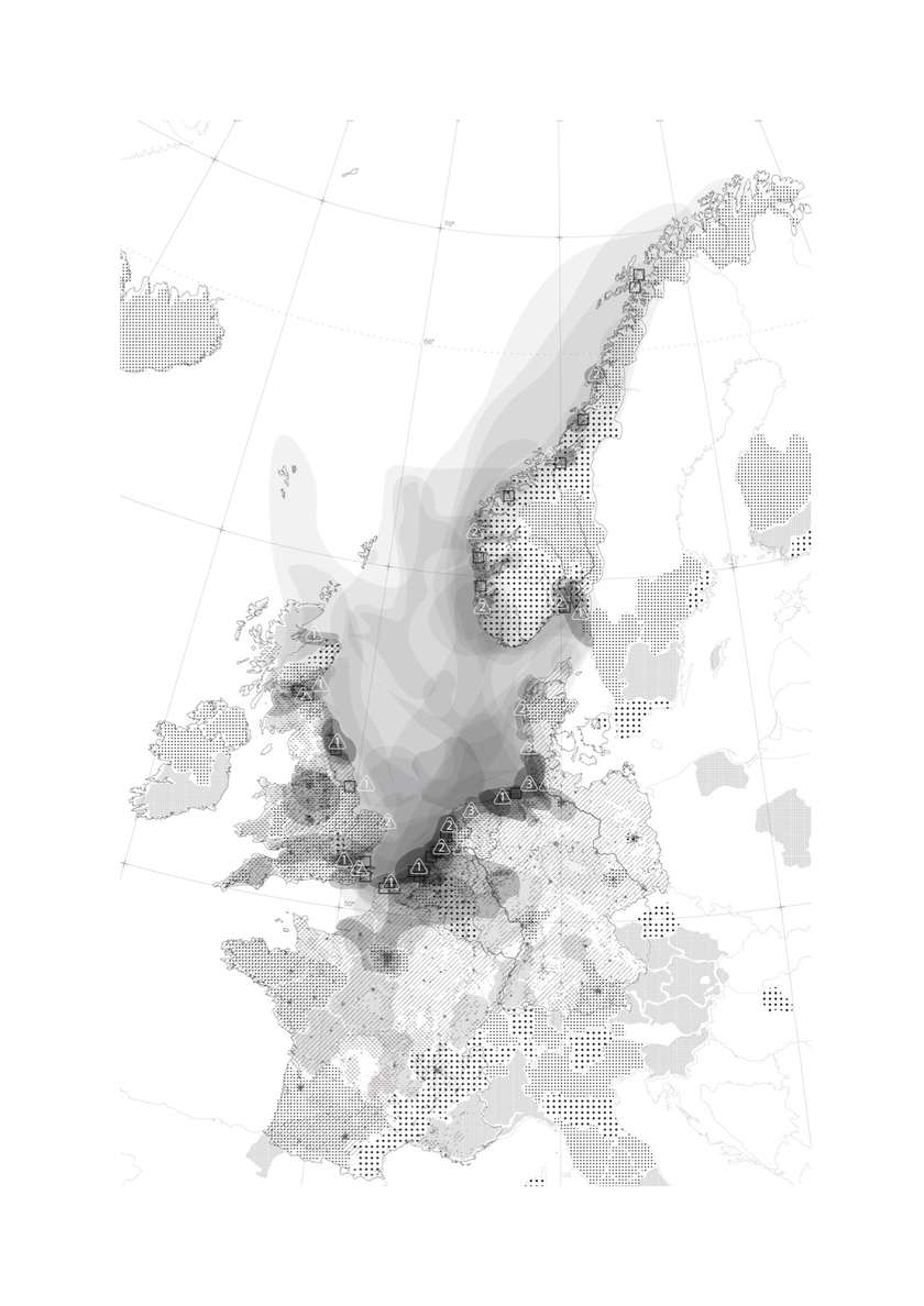
This conclusion map shows the relation between concentration of pollutants and human activity. Dark areas are particularly affected by pollution, which has negative effects on food quality, health, and biodiversity as some example. These areas would require to implement measures to both decrease further emissions and to remove current pollutants from their land, water and air.

Artificial structures construction activities in the North Sea area.
Aggregates, sand and gravel withdrawal sites in Norway indicate existing and possible sites for utilising raw materials in constructions.
Land reclaimation projects
Hard defenses
Soft defenses
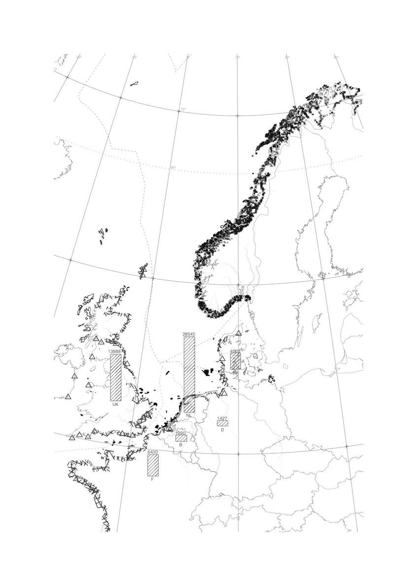
Marine sediment extraction area in 2007
Aggregates withdrawal in Norway
Sand and gravel withdrawal in Norway
Total volume of extraction of sand, maerl and gravel in 2007 (thousand m3)