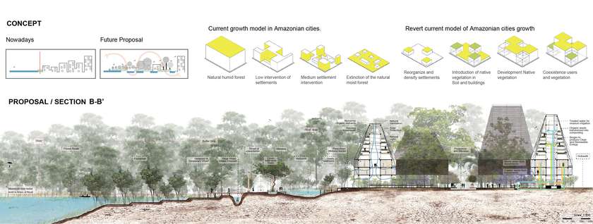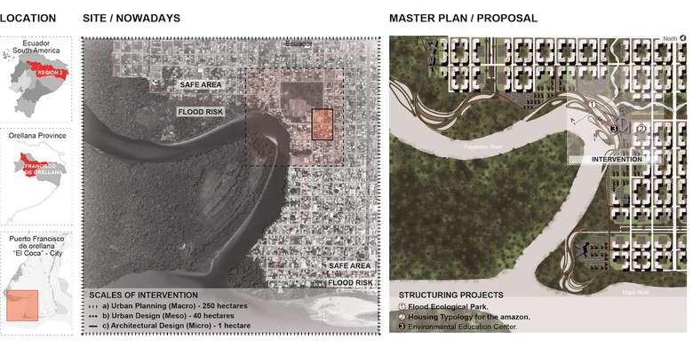
The development of this project takes place in Puerto Francisco de Orellana and stresses the importance of its implementation for the future architecture and urban planning of the city, adapting it to its environment, and responding to the site in order to restore contact between the city, water and nature; Breaking the barrier that currently exists between them with the purpose of creating a global set that works together (Relief & Topography, Blue & Green Infrastructure, Mobility & Transportation), and also, establishing High-performance buildings with adaptable designs for a Community Empowerment, creating Smart and Sustainable Neighborhoods.
In addition, the influence of the project for the future of architecture, focuses mainly on the idea of relating in the best way with nature (flora, fauna, water, etc.), that gives us the planet earth, ending with the destruction of the natural environment, so that there is a harmonious coexistence between the human, cities and nature.

There is a growing need to reduce the environmental impact; Achieving the objectives of environmental focus of the current administration, enhancing sustainable development and, most importantly, respect for nature; Where the image of the city integrates with the rivers, and achieves by combining and protecting the hydrological and ecological values of the urban and natural landscape, the result to obtain a new Amazon Referent for the future and a great example of Green-Blue City.
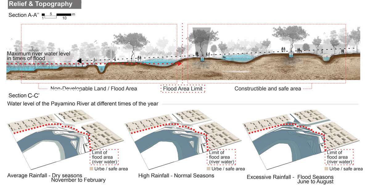
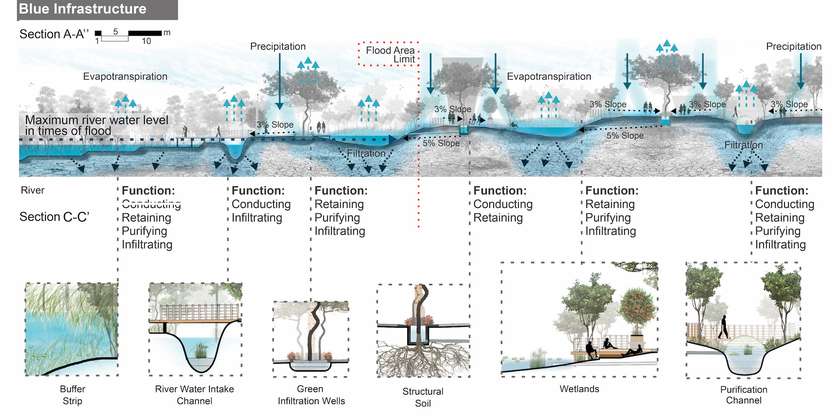
In order to take advantage of the floods caused by the river and the urban runoff of the city, a topographic and relief design is developed, also contributing with a new dynamic landscape that includes: eminences, plains and depressions of the ground.
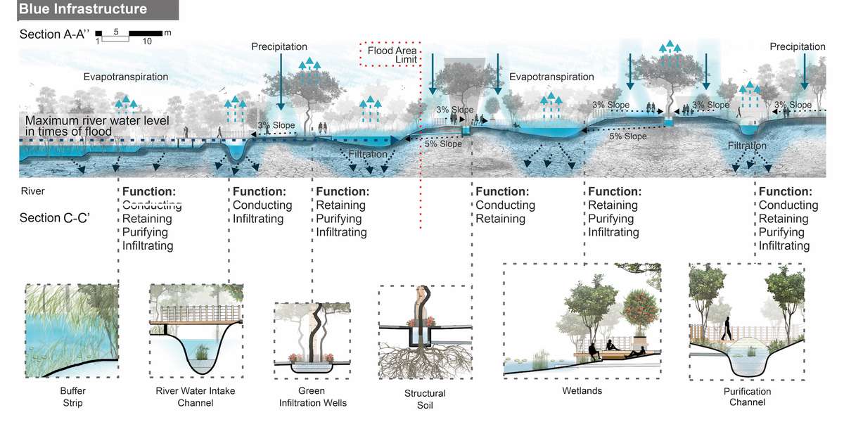
A network of blue infrastructures is designed through differentiated systems responsible for conducting, retaining, purifying and infiltrating runoff and floodwaters; Technically defined by hydrological patterns that characterize each of the following types of infrastructure for a control floods in an ecological way.

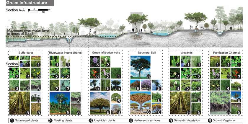
In order to structure the city and nature; An ecological network is strategically designed conserving the natural heritage and regenerating the destroyed natural area, connecting and distributing the green of the city equitably from the type and vegetation stratum, which fulfill specific functions in each proposed infrastructure.

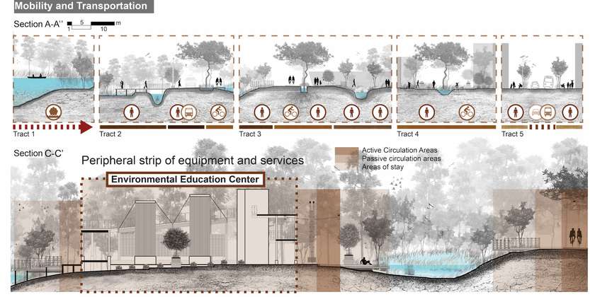
The public space for the pedestrian is maximized and minimized for the motor vehicle in order to make Puerto Francisco de Orellana a walking city. Establishing river and terrestrial accessibility to the physical environment, and creating a river circuit as a new mobility system.